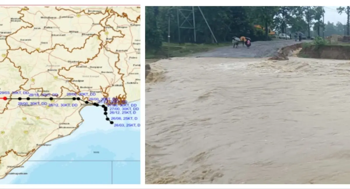
Bhubaneswar: With the deep depression moving across Odisha at a very slow pace, heavy downpour continued to pound several parts of the state.
At least 11 places in the state recorded extremely heavy rainfall, while 34 stations received very heavy rain and 38 stations experienced heavy downpour in the last 24 hours, the India Meteorological Department (IMD) said on Wednesday.
As per IMD data, the highest rainfall was recorded at Bijepur in Baragada district with 315 mm, followed by Agalpur in Balangir with 264 mm, Salebhatta in Balangir with 256.8 mm, Barapali in Baragada with 252 mm, and Gaisilet in Baragada with 251 mm. Many other places in Baragada, Balangir, Sonpur, Sambalpur, Kendujhar, and Anugola districts also received more than 150 mm of rainfall.
This intense and widespread rainfall has led to flooding in several districts, particularly in northern and western Odisha. Rivers like the Baitarani and Salandi have crossed danger levels, prompting authorities to close schools and colleges in multiple districts and deploy NDRF and ODRAF teams for rescue and relief operations.
The weather agency has warned of continued heavy to very heavy rainfall in many parts of the state over the next 24 hours.
Meanwhile, the deep depression over north interior Odisha and adjoining areas of south Jharkhand & Chhattisgarh moved westwards with a speed of 15 kmph. The system lay centred over central parts of Chhattisgarh & adjoining north interior Odisha, 80 km northwest of Sambalpur in Odisha, in the morning.
It is likely to continue to move nearly westwards across Chhattisgarh and east Madhya Pradesh during next 24 hours.
As the deep depression triggered extremely heavy downpour and severe flooding in Odisha, meteorological scientists have attributed the unusual weather to the very slow movement of the system.
The low-pressure area developed over the Northwest Bay of Bengal on July 25, which intensified into a depression and deep depression the next day on July 26. However, the system moved at an exceptionally slow pace. Even after four days, it remains inside Odisha, having travelled less than 500 kilometres since its formation. This abysmally slow movement has caused prolonged heavy to very heavy rainfall over the state, triggering flood situations in multiple districts, particularly in northern and central Odisha, they said.
“Very slow movement of the system…#LowPressure on 25th over Northwest Bay of Bengal, #Depression on 26th over same area…..Still after 4days system near Jharsuguda..travel less than 500km ….This has bring huge amount of downpour leading to flooding conditions across the state,” weather scientist U S Dash said in post on X