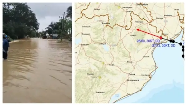
Bhubaneswar: The Deep Depression over northwest Bay of Bengal crossed West Bengal-north Odisha coasts close to Digha late Monday, according to India Meteorological Department (IMD).
The system was about 30 km west-northwest of Digha (West Bengal), 30 km northeast of Baleshwar (Odisha), 50 km east-southeast of Baripada (Odisha), 160 km southeast of Jamshedpur (Jharkhand) and 170 km east of Kendujhar (Odisha) at 5.30 am. It is very likely to continue to move west-northwestwards across north Odisha, south Jharkhand and north Chhattisgarh during the next 24 hours, it added.
Under its influence, Baleshwar received 246.6 mm in the last 24 hours, ending at 8.30 am, followed by Nilagiri at 239 mm, Remuna at 222 mm and Betanati at 202 mm.
According to the MeT office, heavy to very heavy rain with extremely heavy rainfall may continue in Odisha on July 28. The intensity of showers may decrease thereafter with isolated to scattered rainfall from July 29-31. Heavy rain may resume again from August 1-3. Thunderstorm, lightning & gusty winds (speed reaching 40-50 kmph gusting to 60 kmph) is also likely in Odisha on July 28-29.
On Monday, the IMD had warned of heavy to very heavy rainfall in the districts of Sundaragada, Jharsuguda, Baragada, and Sambalpur. Heavy rainfall may also occur at a few places in Baleshwar, Bhadrak, Jajpur, Debagada, Anugola, Dhenkanal, Kendujhar, Mayurbhanj, Sonpur, Boudh, Nuapada and Balangir.