Bhubaneswar: The Depression over north Chhattisgarh and adjoining Jharkhand may gradually weaken by Sunday, the India Meteorological Department (IMD) informed on Saturday.
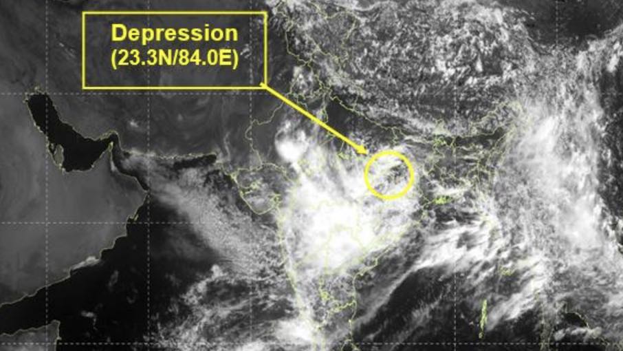
“The Depression over Jharkhand and neighbourhood moved nearly westwards with a speed of 28 kmph during past 6 hours and lay at 8.30am over north Chhattisgarh and adjoining Jharkhand, about 80 km south of Daltonganj (Jharkhand), 80 km east of Ambikapur (Chhattisgarh), 220 km eastnortheast of Pendra Road (Chhattisgarh) and 320 km east of Umaria (Madhya Pradesh). It is very likely to continue to move nearly westwards across north Chhattisgarh and east Madhya Pradesh and weaken gradually into a well-marked low-pressure area by tomorrow,” it said.
The forecast has come as a relief for Odisha, which is staring at a flood-like situation amid rise in the Hirakud dam’s water-level due to heavy rainwater inflow from upper catchment areas. Two Engineers-in-Chief have been deputed from Bhubaneswar to Subarnarekha and Baitarani basins to monitor the situation.
Also Read: 20 Sluice Gates Of Hirakud Dam Opened; Odisha On Flood Alert As Depression Triggers Heavy Rain
According to the weather agency, the state will continue to receive heavy to very heavy rain for one more day under the influence of this system.
An orange warning has been issued for Sundargarh district, which may experience heavy to very heavy rain along with thunderstorm/lightning with gusty surface wind speed reaching 30-40 kmph on July 26. Heavy rain along with thunderstorm/lightning and gusty surface wind speed reaching 30-40 kmph is also likely at one or two places in Jharsuguda, Sambalpur, Bargarh, Deogarh and Sonepur. Thunderstorm/lightning with gusty surface wind speed reaching 30-40 kmph may also occur at one or two places in Dhenkanal, Keonjhar, Mayurbhanj, Nuapada, Kalahandi, Kandhamal, Nabarangpur, Rayagada, Koraput, Malkangiri, Angul, Boudh and Balangir.
On July 27, yellow warning of thunderstorm along with lightning and gusty surface wind speed reaching 30-40 kmph has been issued for one or two places in Balasore, Bhadrak, Jajpur, Kendrapada, Cuttack, Jagatsinghpur, Sundargarh, Jharsuguda, Bargarh, Sambalpur, Deogarh, Angul, Dhenkanal, Keonjhar and Mayurbhanj districts.
It further stated that squally weather with wind speed reaching 35-45 kmph gusting to 55 kmph may prevail over North Bay of Bengal, along & off Odisha, West Bengal and Bangladesh coasts on July 26-27.
While light to moderate rain may continue at some places in the state during the next three days, there is no weather warning. Heavy rain may resume again on August 1 at some places in Odisha with no warning thereafter.