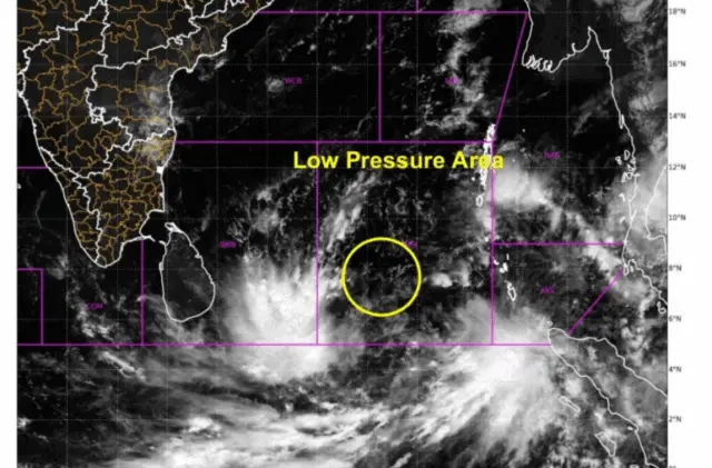
Bhubaneswar: Another low-pressure area formed over the Bay of Bengal on Friday and the system is set to intensify into a cyclonic storm next week, the India Meteorological Department (IMD) said.
Under the influence of yesterday’s upper-air cyclonic circulation over central Andaman Sea and adjoining Andaman & Nicobar Islands, a low-pressure area formed over Southeast Bay of Bengal in the morning, it said.
The system is likely to move north-westwards, become well-marked low-pressure area on November 14 and then intensify into a depression over the same region around morning of November 15.
Thereafter, it is likely to move north-north-westwards and intensify further into a cyclonic storm over the central Bay of Bengal around November 16 evening, the weather agency said, issuing heavy rain alert for several parts of the state next week.
In its weather bulletin, the IMD issued a yellow warning of heavy rain over Kendrapada, and Jagatsinghapur districts on November 18-19.
This apart, thunderstorm accompanied by lightning and gusty surface wind (speed reaching 30-40 kmph) is likely to occur in the districts of Baleshwar, Bhadrak, Jajpur, Kendrapada, Jagatsinghapur, Kataka, Kendujhar, Mayurbhanj, Gajapati, Ganjam, Puri, Khordha, and Nayagada during the period.
On November 19-20, heavy rain is likely to lash the districts of Rayagada, Gajapati, Ganjam, and Puri, where a yellow warning has been sounded.
Besides, thunderstorm with lightning and gusty surface wind may occur over the districts of Baleshwar, Bhadrak, Jajpur, Kendrapada, Jagatsinghapur, Kataka, Rayagada, Gajapati, Ganjam, Puri, Khordha, and Nayagada during the period.
Squally weather with wind speed reaching 45-55 kmph and occasionally gusting to 65 kmph is likely to prevail along & off the south Odisha coast on November17. Sea condition is likely to be rough to very rough.
Fishermen are advised not to venture into the sea along & off the south Odisha coast on November 17.