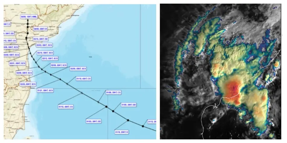
Bhubaneswar: Heavy rain continued to lash some parts of Odisha even as the depression, remnant of severe cyclonic storm Murasu, weakened into a well-marked low pressure on Wednesday, the India Meteorological Department IIMD) said.
The depression over east Telangana & adjoining coastal Andhra Pradesh weakened into well marked low pressure area over the same region at 11.30 am. Continuing to move nearly northwards, it is very likely to weaken further into a low pressure area over the same region during next 12 hours.
According to the weather agency, heavy rain and thunderstorm activity is likely to continue in several parts of the state. It has sounded a yellow warning for two days.
In a weather bulletin, the IMD issued a yellow warning of heavy rainfall over the districts of Koraput, and Malkangiri till the morning of Thursday.
This apart, thunderstorm accompanied by lightning and gusty surface wind (wind speed reaching 30-40 kmph gusting to 50 kmph) is likely to occur over the districts of Baleshwar, Bhadrak, Sundaragada, Jharsuguda, Baragada, Sambalpur, Debagada, Kendujhar, Mayurbhanj, Nuapada, Balangir, Kalahandi, Nabarangpur, Rayagada, Koraput, Malkangiri, and Gajapati during the period.
On November 5-6, thunderstorm with lightning and gusty surface wind is likely to occur in Kataka, Sundaragada, Jharsuguda, Baragada, Sambalpur, Debagada, Anugola, Subarnapur, Boudh, Nuapada, Balangir, Kalahandi, Kandhamala, Nawarangpur, Rayagada, Koraput, Malkangiri, Gajapati, Ganjam, Puri, Khordha, and Nayagada districts. A yellow warning has been issued for these districts during the period.