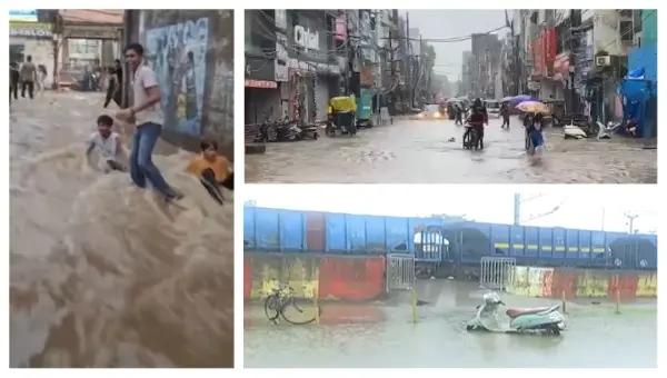
Bhubaneswar: The well-marked low-pressure area over coastal West Bengal and neighbouring areas of Bangladesh and the Northwest Bay of Bengal concentrated into a depression over coastal West Bengal, about 190 km eat-niortheat of Baripada in Odisha, on Thursday.
The system is expected to continue its northwestward track across Gangetic West Bengal towards Jharkhand in the next 24 hours, according to the India Meteorological Department (IMD).
Under its influence, heavy to extremely heavy rainfall has already lashed several parts of Odisha, prompting a red warning from the weather office and causing widespread disruption in northern and coastal districts. Relentless downpours have inundated areas including Rourkela, Baleshwar, Kendujhar and Mayurbhanj, leaving major roads, railway stations and residential neighbourhoods waterlogged. District administrations have closed schools in affected regions such as Mayurbhanj, while fishermen have been advised to stay ashore for at least the next 24 hours amid rough sea conditions.
In Rourkela in Sundaragada district, torrential rain that began in the early hours flooded primary roads, government hospital compounds and low-lying residential sectors. At the railway station, Platform No. 5 and surrounding staircases were submerged, forcing passengers to wade through knee-deep water. The second entrance was also inundated. In slum areas such as Indira Nagar, floodwaters entered homes, damaging belongings and compelling families to seek higher ground near the station.
Residents reported that water levels rose rapidly from around midnight, marking a second severe flooding episode within days. Ground-floor houses in Bishwakarma Vihar in Vedvyas, Dandiapali, Sheetal Pada and Telgu Basti in Uditnagar, as well as Machhali Market, were similarly affected, while the road linking Vedvyas with TCI remained completely submerged, halting traffic. Schools across the city were shut due to the continuous downpour that brought normal life to a standstill.
Conditions were equally severe in Baleshwar district, where more than 137 mm of rain was recorded in the last 24 hours. Key arterial routes, including the Remuna–Balasore bus stand road and Nawa Sahi, lay under up to two feet of water, blocking vehicular movement. Ambulances and other emergency vehicles became stranded or were forced onto hazardous detours, while ground-floor shops suffered significant commercial losses for the second time this season, according to sources.
In Mayurbhanj, incessant overnight rain across all 26 blocks, including Baripada and the Similipal catchment, produced a flood-like situation. Approximately four feet of water flowed over a bridge in Sarumula in the Rasgovindpur block, severing the vital Baripada-Amarda road. Heavy discharge from the Similipal hills caused the Budhabalanga River to swell rapidly, while rising levels in the Jambhira River (known as the Jolaka in neighbouring Baleshwar) raised fears of downstream flooding. Low-lying areas, slums and residential pockets in Baripada town experienced acute waterlogging after rainwater entered houses.
The District Collector inspected affected zones and oversaw relief efforts, with all schools, colleges and educational institutions ordered closed as a precautionary measure.
Notably, the IMD has issued a red warning of extremely heavy rainfall for Kendujhar district on Thursday. Heavy to very heavy rain may also continue in Baleshwar, Jajpur, Kataka, Sundaragada, Sambalpur, Debagada, Anugola, Dhenkanal, and Mayurbhanj. Thunderstorm accompanied by lightning and gusty surface wind (30-40 kmph) very likely to occur at one ortwo places in the districts of Baleshwar, Bhadrak, Jajpur, Kendrapada, Jagatsingapur, Kataka, Sundaragada, Jharsuguda, Baragada, Sambalpur, Debagada, Anugola, Dhenkanal, Kendujhar, Mayurbhanj, Subarnapur, Boudh, Nuapada, Balangir, Kalahandi, Kandhamala, Nabarangpur, Rayagada, Koraput, Malkangiri, Gajapati, Ganjam, Puri, Khordha and Nayagada.
Rainfall intensity is expected to gradually decrease from August 14 onwards, though heavy rainfall warnings remain active for northwestern districts including Sundaragada, Jharsuguda, Sambalpur, and Kendujhar through August 17. Thunderstorm activity may also continue in Sundaragada, Jharsuguda, Sambalpur, Debagada, Anugola, Kendujhar, and Mayurbhanj during this period..