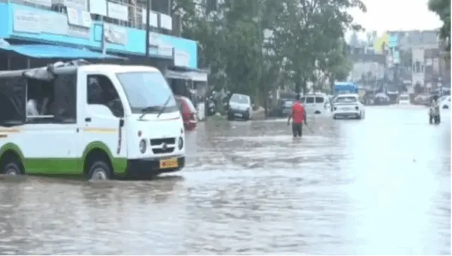
Bhubaneswar: A fresh low-pressure area is likely to form over the Bay of Bengal around Saturday and trigger heavy to very heavy rain in Odisha over the next week, the India Meteorological Department (IMD) said on Friday.
Under the influence of the upper air cyclonic circulation over North Bay of Bengal & adjoining West Bengal-Bangladesh coasts, a low pressure area is likely to form over northwest Bay of Bengal and adjoining West Bengal-north Odisha coasts around August 29.
The IMD has issued red, orange and yellow warnings for several parts of Odisha till the morning of September 4. Heavy to extremely heavy rain is expected to pound several Odisha districts during the period.
In its midday weather bulletin, the Meteorological Centre in Bhubaneswar has issued an orange warning of heavy to very heavy rain over the districts of Baleshwar, Kendujhar, and Mayurbhanj during the next 24 hours.
The weather agency has issued a yellow warning of heavy rain over the districts Bhadrak, Jajpur, Kendrapada, Jagatsinghapur, Kataka, Sundaragada, Sambalpur, Debagada, Anugola, Dhenkanal, Koraput, Malkangiri, Puri, Khordha, and Nayagada during the period.
Similarly, thunderstorm with lightning and gusty surface wind (wind speed reaching up to 40-50 kmph) may occur over the districts Baleshwar, Bhadrak, Jajpur, Kendrapada, Jagatsinghapur, Kataka, Sundaragada, Anugola, Dhenkanal, Kendujhar, Mayurbhanj, Puri, Khordha, and Nayagada.
On August 29-30, the IMD has issued an orange warning of heavy to very heavy rain over the districts of Baleshwar, Bhadrak, Jagatsinghapur, Kendujhar, Kendrapada, and Mayurbhanj.
Similarly, yellow warning of heavy rain was issued for Jajpur, Kataka, Sundaragada, Jharsuguda, Baragada, Sambalpur, Debagada, Anugola, Dhenkanal, Subarnapur, Boudh, Nuapada, Balangir, Kalahandi, Kandhamala, Nawarangpur, Puri, Khordha, and Nayagada.
Thunderstorm accompanied by lightning and gusty surface wind (wind speed reaching up to 40-50 kmph) may occur at one or two places over the districts Baleshwar, Bhadrak, Jajpur, Kendrapada, Jagatsinghapur, Kataka, Sundaragada, Anugola, Dhenkanal, Kendujhar, Mayurbhanj, Puri, Khordha, and Nayagada.
On August 30-31, the IMD has issued a red warning of heavy to very heavy rainfall at a few places with extremely heavy downpour at one or two places of Mayurbhanj district.
Orange warming was issued for the districts of Baleshwar, Bhadrak, Jajpur, Sundaragada, Debagada, Anugola, Kendujhar, and Dhenkanal, while the IMD sounded a yellow alert for Kendrapada, Jagatsinghapur, Kataka, Jharsuguda, Baragada, Sambalpur, Mayurbhanj, Subarnapur, Boudh, Nuapada, Balangir, Kalahandi, Kandhamala, Puri, Khordha, and Nayagada.
Thunderstorm accompanied by lightning and gusty surface wind may occur at one or two places over the districts Baleshwar, Bhadrak, Jajpur, Kendrapada, Jagatsinghapur, Kataka, Sundaragada, Debagada, Anugola, Dhenkanal, Kendujhar, Mayurbhanj, Puri, Khordha, and Nayagada.
On August 31-Sept 1, an orange warning of heavy to very heavy rain was issued for the districts of Sundaragada, Jharsuguda, Baragada, Sambalpur, while yellow alert was sounded for Baleshwar, Debagada, Anugola, Kendujhar, Mayurbhanj, Subarnapur, Boudh, Nuapada, Balangir, and Kalahandi.
The weather agency has stated that heavy rain is expected to continue in different districts of the state till the morning of September 4.
As squally weather with wind speed reaching 40-50 kmph occasionally gusting to 60 kmph is very likely to prevail along & off the Odisha coast till August 31, fisherman have been advised not to venture into the sea during the period.