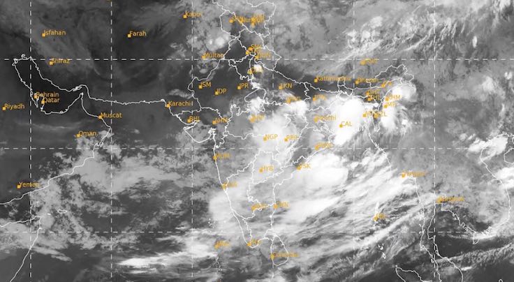
Bhubaneswar: A low-pressure area has formed over the north Bay of Bengal and it is expected to intensify further in the next 24 hours, the India Meteorological Department (IMD) informed on Thursday.
“The remnant of Tropical Cyclone Wipha has emerged and under its influence, a Low Pressure area has formed over the north Bay of Bengal at 5.30 am. It is likely to become well marked during the next 24 hours,” according to the morning bulletin.
It further stated that the system is expected to move west-northwestwards towards North Odisha and adjoining West Bengal coasts during the next 48 hours.
Under its influence, Odisha is likely to experience very heavy rainfall from July 24-26. Squally weather with wind speed reaching 35-45 kmph gusting to 55 kmph may also prevail along & off Odisha coasts, West Bengal & Bangladesh coasts from July 24-27. Since the sea conditions are likely to be rough to very rough, fishermen have been advised against venturing into the sea during this period.
Forecast for Odisha
Orange Warning: On July 24, heavy to very heavy rain accompanied by thunderstorm/lightning and gusty surface wind speed reaching 30-40 kmph is likely at one or two places in Mayurbhanj, Keonjhar, Malkangiri and Koraput. Heavy rain along with thunderstorm/lightning and gusty surface wind speed reaching 30-40 kmph may also pound one or two places in Sundargarh, Deogarh, Balasore, Bhadrak, Kendrapada, Jajpur, Dhenkanal and Angul. There is also a warning of thunderstorm/lightning with gusty surface wind speed reaching 30-40 kmph for one or two places in Cuttack, Jagatsinghpur, Puri, Khurda, Nayagarh, Ganjam and Gajapati.
Red Warning: The intensity of rain is likely to increase on July 25 when extremely heavy rain along with thunderstorm/lightning and gusty surface wind speed reaching 30-40 kmph may occur at one or two places in Mayurbhanj and Keonjhar districts. Heavy to very heavy rain accompanied by thunderstorm/lightning and gusty surface wind speed reaching 30-40 kmph is also likely at one or two places in Balasore, Bhadrak, Jajpur, Angul, Dhenkanal, Kendrapara, Jagatsinghpur, Sundargarh.
Heavy rain along with thunderstorm/lightning and gusty surface wind speed reaching 30-40 kmph may also occur in Bargarh, Cuttack, Nayagarh, Khurda, Boudh, Sonepur, Nabarangpur, Koraput, Kandhamal, Sambalpur, Jharsuguda, Deogarh, Balangir, Nuapada and Kalahandi. There is also a warning of thunderstorm/lightning with gusty surface wind speed reaching 30-40 kmph for one or two places in Puri, Ganjam, Gajapati, Rayagada and Malkangiri.
Orange Warning: On July 26, heavy to very heavy rain accompanied by thunderstorm/lightning and gusty surface wind speed reaching 30-40 kmph may continue at one or two places in Mayurbhanj, Keonjhar and Sundargarh. Heavy Rain along with thunderstorm/lightning and gusty surface wind speed reaching 30-40 kmph is also likely at one or two places in Dhenkanal, Angul, Deogarh, Sambalpur, Jharsuguda, Bargarh, Malkangiri, Koraput and Gajapati. There is also a warning of thunderstorm/lightning with gusty surface wind speed reaching 30-40 kmph for one or two places in Balasore, Bhadrak, Jajpur, Kendrapada, Cuttack, Jagatsinghpur, Puri, Khurda, Nayagarh, Ganjam, Sonepur, Boudh, Nuapada, Balangir, Kalahandi, Kandhamal, Nabarangpur and Rayagada.
Yellow Warning: On July 27, heavy rain along with thunderstorm/lightning and gusty surface wind speed reaching 30-40 kmph may occur at one or two places in Bargarh, Jharsuguda, Sambalpur, Sundargarh. Thunderstorm/lightning along with gusty surface wind speed reaching 30-40 kmph is also likely at one or two places in Deogarh, Angul, Dhenkanal, Keonjhar, Mayurbhanj, Sonepur, Boudh, Nuapada, Balangir, Kalahandi, Kandhamal, Nabarangpur, Rayagada, Koraput and Malkangiri.