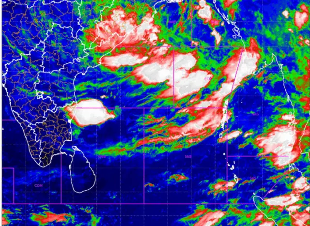
Bhubaneswar: Rainfall intensity is likely to increase in several parts of Odisha as a fresh low-pressure area has formed over the Bay of Bengal and adjoining areas on Thursday, the India Meteorological Department (IMD) said.
The low-pressure area formed at 5.30 am under the influence of an upper-air cyclonic circulation over the North Bay of Bengal and neighbouring Bangladesh.
The weather system is expected to trigger heavy to extremely heavy rain in many districts of Odisha over the next few days.
A red warning has been issued for Mayurbhanj where heavy to very heavy rainfall at a few places with extremely heavy rainfall at one or two places is very likely during the next 24 hours.
Similarly, an orange warning of heavy to very heavy rainfall has been issued for Baleshwar, Bhadrak and Kendujhar. Thunderstorm with 40-50 kmph wind is likely over Baleshwar, Bhadrak, Kendujhar and Mayurbhanj districts during the period.
Besides, yellow warning of heavy rain has been issued for Jajpur, Kendrapada, Jagatsinghapur, Kataka, Anugola, Dhenkanal, Kalahandi, Rayagada, Koraput, Gajapati, Ganjam, Puri and Khordha.
The IMD has forecast squally winds with speeds of 40 to 50 kmph and gusting up to 60 kmph over the North and Central Bay of Bengal during the next 48 hours. Similar conditions are expected along and off the coasts of Bangladesh, West Bengal, Odisha and north Andhra Pradesh.
Sea conditions are also likely to remain rough to very rough over the North and Central Bay of Bengal during the same period.
The weather agency has advised fishermen not to venture into the North and Central Bay of Bengal and along and off the coasts of Bangladesh, West Bengal, Odisha and north Andhra Pradesh for the next 48 hours.