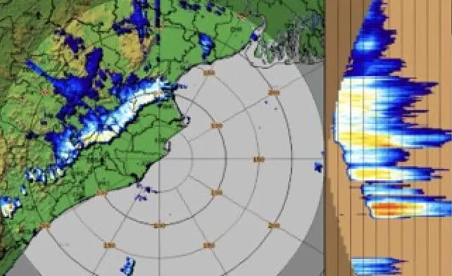
Bhubaneswar: The India Meteorological Department (IMD) has issued a nowcast warning for 10 districts of Odisha, including state capital Bhubaneswar, till 7 pm on Friday.
Thunderstorm with lightning, light to moderate rain and wind speed reaching 40-50 kmph may lash one or two places in the districts of Keonjhar, Ganjam, Kandhamal, Khurda (including Bhubaneswar), Puri, Jagatsinghpur, Kendrapada, Rayagada, Angul and Sundargarh during the next th
ree hours.
People have been advised to keep a watch on the weather and move to safer places to protect themselves from lightning strikes.
This morning, coastal and capital regions experienced total cloud cover, while western and northern districts saw heavily overcast, slightly broken skies. Perfect “8 Oktas” readings in Bhubaneswar, Chandbali, Puri, and Paradip signalled a high probability of sustained rain. This heavy cover coincides with the India Meteorological Department’s forecast of a potential low-pressure system, the season’s first, forming around June 24–25 over the North Bay of Bengal and the adjoining Odisha coast. Such systems act as catalysts for monsoon advancement by strengthening winds, enhancing moisture transport, and pulling the monsoon current further north.
This is good news for Odisha where the southwest monsoon went into a hiatus on June 15 after its onset on June 12. While monsoon’s progress has remained slow due to the absence of a strong weather system over the Bay of Bengal, rainfall activity in the state is expected to increase after June 26.