Bhubaneswar: The India Meteorological Department (IMD) on Wednesday issued a red warning for Odisha on October 2, coinciding with Dussehra festivities.
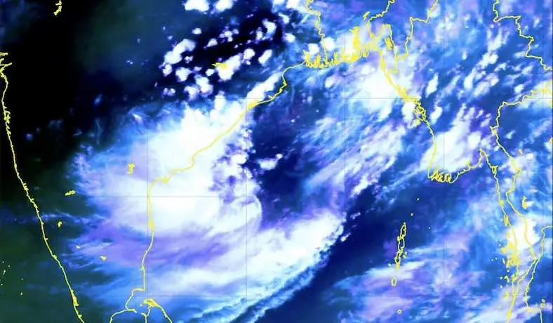
Heavy to very heavy rainfall with isolated extremely heavy falls along accompanied by thunderstorm/ lightning and gusty surface wind speed reaching 40-50 kmph is likely in the districts of Jagatsinghpur and Puri under the influence of the well-marked low pressure over westcentral Bay of Bengal expected to concentrate into a Depression during the next 12 hours and intensify further into a deep depression, crossing South Odisha- North Andhra Pradesh coasts during the early hours of October 3.
Orange warning of isolated heavy to very heavy rainfall along with thunderstorm/lightning and gusty surface wind speed reaching 40-50 kmph has been issued for one or two places in Mayurbhanj, Balasore, Bhadrak, Kendrapada, Jajpur, Cuttack, Khurda, Nayagarh, Ganjam, Gajapati, Kalahandi, Kandhamal, Balangir, and Dhenkanal.
Isolated heavy rainfall along with thunderstorm/lightning and gusty surface wind speed reaching 40-50 kmph is also likely in Malkangiri, Koraput, Rayagada, Nabarangpur, Bargarh, Sonepur, Boudh, Angul and Keonjhar districts. There is also a warning of thunderstorm/lightning accompanied by gusty surface wind speed reaching 30-40 kmph for one or two places in Nuapada, Sundargarh, Jharsuguda, Sambalpur and Deogarh.
The intensity of rain may gradually decrease thereafter.
On October 3, heavy to very heavy rainfall along with thunderstorm/lightning and gusty surface wind speed reaching 40-50 kmph may occur at one or two places in Nabarangpur, Nuapada and Bargarh.
Heavy rainfall along with thunderstorm/lightning and gusty surface wind speed reaching 30-40 kmph is also likely at one or two places in Mayurbhanj, Keonjhar, Sundargarh, Deogarh, Jharsuguda, Sambalpur, Sonepur, Balangir and Kalahandi. Thunderstorm/lightning accompanied by gusty surface wind speed reaching 30-40 kmph may also occur at one or two places in Dhenkanal, Malkangiri, Angul, Koraput, Rayagada, Boudh, Kandhamal, Puri, Khurda, Nayagarh, Ganjam, Gajapati, Bhadrak Balasore Jagatsinghpur , Jajpur, Kendrapada and Cuttack.
Though there no heavy rain warning thereafter, thunderstorm/lightning and gusty surface wind speed reaching 30-40 kmph may continue in districts of Sundargarh, Jharsuguda, Bargarh, Sambalpur, Deogarh, Angul, Dhenkanal, Keonjhar, Mayurbhanj, Balasore, Bhadrak, Jajpur, Kendrapada, Cuttack, Jagatsinghpur, Puri, Khurda, Nayagarh, Ganjam and Gajapati on October 4-5.
Today’s IMD Forecast
Heavy rain accompanied by thunderstorm/lightning and gusty surface wind speed reaching 40-50 kmph may occur at one or two places in the districts of Ganjam, Gajapati, Rayagada, Koraput, Malkangiri, Kandhamal, Kalahandi, Nabarangpur and Puri.
Thunderstorms along with lightning and gusty surface wind speed reaching 40-50 kmph is also likely at one or two places in Khurda and Nayagarh. Thunderstorm along with lightning and gusty surface wind speed reaching 30-40 kmph may also occur at one or two places in Sonepur, Boudh, Nuapada, Balangir, Balasore, Bhadrak, Jajpur, Kendrapada, Cuttack, Jagatsinghpur, Sundargarh, Jharsuguda, Bargarh, Sambalpur, Deogarh, Angul, Dhenkanal, Keonjhar and Mayurbhanj.
Squally wind speed reaching 40-50 gusting to 60 kmph may also prevail over central & adjoining north Bay of Bengal on October 1. It would gradually increase becoming 55-65 gusting to 75 kmph over westcentral and adjoining northwest Bay of Bengal from noon of October 2 noon to October 3 early morning.
CEC Forecast
According to Centre for Environment and Climate (CEC) of SOA Deemed to be University here, the low-pressure area over the west- central Bay of Bengal off South Andhra Pradesh coast may turn into a depression by Wednesday evening or night and slightly change its direction and move in a north-north westerly direction and cross Odisha coast near Chilika lake between Ganjam and Puri districts in the afternoon of Thursday.
Director of CEC S C Sahu said that the system will thereafter move across Odisha towards Chhattisgarh-Jharkhand till Friday.
Under its influence, moderate rain may be experienced at most places over coastal, western and north eastern districts of the state. Some places may experience heavy to very heavy rainfall.
The districts likely to be affected include Puri, Ganjam, Jagatsinghpur, Kendrapara, Bhadrak, Balasore, Jajpur, Mayurbhanj, Keonjhar, Dhenkanal, Angul, Deogarh, Sambalpur, Sundergarh, Boudh, Sonepur, Kandhamal, Balangir and Bargarh.
Rain will cease from Friday afternoon, he added.