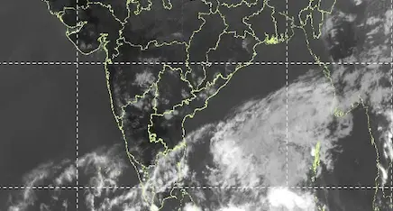
Bhubaneswar: The well-marked low pressure area over southwest Bay of Bengal is likely to move west-northwestwards initially and then gradually recurve northeastwards over the same region during the next 48 hours, the India Meteorological Department (IMD) informed on Sunday.
The weather agency has sounded a yellow warning for 10 districts of Odisha for two days.
Under the influence of the system, thunderstorm accompanied by lightning and gusty surface wind reaching 30-40 kmph may occur
at isolated places over the districts of Malkangiri, Koraput, Nabarangpur, Kalahandi, Mayurbhanj, Keonjhar, Balasore and Bhadrak on February 23. Similar weather conditions may prevail in Mayurbhanj, Jajpur and Cuttack districts during the subsequent 24 hours.
Light rain or thunderstorm is also likely at one or two places in Sundargarh, Malkangiri, Koraput, Rayagada, Nabarangpur, Mayurbhanj, Balasore, Bhadrak, Cuttack, Jagatsinghpur, Kendrapada, Khurda, Puri, Keonjhar, Jajpur and Kalahandi and Dhenkanal districts during on two days.
The IMD has also forecast a gradual rise in the night temperature by 2-3 degrees during the next 48 hours.
Shallow to moderate fog may occur during early morning hours at one or two places over the district of Balasore, Bhadrak, Jajpur, Kendrapada, Jagatsinghpur and Cuttack on February 22 and Kendrapada, Jagatsinghpur and Puri on February 23, it added.