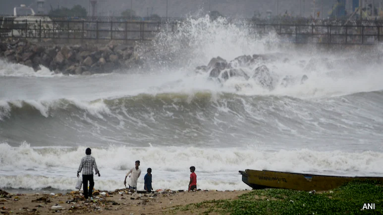
Bhubaneswar: Cyclone Arnab made landfall near Narsapuram on the Andhra Pradesh coast in the early hours of October 28. Odisha also bore the brunt, with heavy rainfall, landslides and floods leading to loss of lives and major agricultural and infra damage in the southern districts.
A week later, Cyclone Murasu crossed the southern Andhra coast, near Ongole, in the early hours of November 3. The effect wasn’t as severe as Cyclone Arnab but still there was significant damage to agriculture and infrastructure, mainly in Andhra.
Now, a third storm is developing in the Bay of Bengal. Cyclone Akvan is expected to intensify into a cyclonic storm and strengthen further over the next three days before landfall along Andhra Pradesh and Yanam coasts as a very severe cyclonic storm on Friday (November 20) noon, with Odisha bracing for heavy to very heavy rain from Wednesday.
What is causing this surge in cyclonic activity in the Bay of Bengal?
According to weather officials and meteorologists, it’s the result of a strengthening El Niño.
The warming effect of El Niño has intensified since August and is likely to reach its strongest level by December, strengthening the northeast monsoon and keeping sea surface temperatures high. Conditions are created for weather systems to rapidly intensify into severe storms, Hindustan Times reported.
“During El Nino years, the north-east monsoon (also popularly known as the winter monsoon) tends to be more vigorous,” KJ Ramesh, former director general of India Meteorological Department (IMD), told HT.
“It primarily affects Tamil Nadu, Kerala, south Andhra Pradesh and south Karnataka. This year also, we are expecting something similar. More rain means more systems developing over the sea. This is also the post-monsoon cyclone season, when sea surface temperatures remain high. Hence, the systems are intensifying into cyclones,” Ramesh explained.
This is not the first time that three cyclones would have hit Andhra Pradesh in the span of less than a month, a senior IMD scientist pointed out.
“Three cyclones hit Andhra Pradesh in November in 1976. In 1987, the state was again hit by three cyclones between October 14 and November 15,” he said.
Both were El Niño years.
“In 2020, the state was hit by two cyclones in November,” he added, explaining that it was attributed to a prolonged La Niña cycle that started in late 2020 and continued till early 2023.
Very severe cyclonic storm Arnab hit Andhra coast with a wind speed of 125-135 kmph, gusting up to 150 kmph, while severe cyclonic storm Murasu lashed the state with a wind speed of 100-110 kmph and gusting up to 120 kmph.
The forecast for Cyclone Akvan is that it will enter the land with wind speeds of around 120-130 kmph, gusting up to 145 kmph.
Traditionally, April and May represent the pre-monsoon cyclone period in India’s east coast, while October and November constitute the post-monsoon cyclone season.
As per IMD data, 33 cyclonic storms formed over Bay of Bengal between 2015 and 2025. Ten of these were in November, 7 in May and 6 in October. Interestingly, 19 of these storms intensified into severe cyclonic storms.
IMD’s director general of meteorology Mrutyunjay Mohapatra said the number of cyclones hasn’t increased over the years. “The rate of intensification has increased, meaning cyclones and severe cyclones are forming at a much faster rate,” he explained.
“During El Nino years, particularly during the post-monsoon cyclone season, the systems tend to form at lower latitudes in the Bay of Bengal. Hence, they tend to hit the coasts of Andhra Pradesh and Tamil Nadu more,” Mohapatra said.
Based on assessment on susceptibility to cyclones, IMD has identified 100 districts, including 74 coastal districts and 26 inland ones within 100 km of the coast,
Twelve of these districts have been classified as very highly prone, including Baleshwar, Bhadrak, Kendrapada and Jagatsinghpur in Odisha.
Twenty-five districts are assessed to be highly prone, 48 moderately prone and the remaining 15 less prone.