Bhubaneswar: Odisha is likely to experience moderate thunderstorm activity with lightning and gusty surface wind during the next 5 days, the India Meteorological Department (IMD) informed on Tuesday.
According to the MeT office, wester disturbances will bring more rain to the state. “Due to likely interaction of middle tropospheric westerly trough with lower level easterly, and moisture incursion from Bay of Bengal, meteorological conditions have become favourable for moderate thunderstorm activity with lightning, gusty surface wind and scattered to fairly widespread rainfall over Odisha in the next 5 days,” it said.
People have been advised to keep a watch on the weather and take shelter during thunderstorm activity to protect from lightning and follow traffic advisories in urban areas. Harvesting of Rabi crops should be regulated judicially, it added.
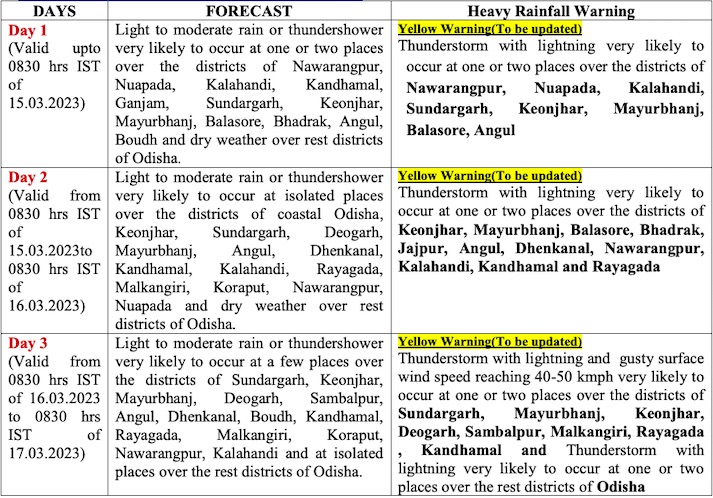
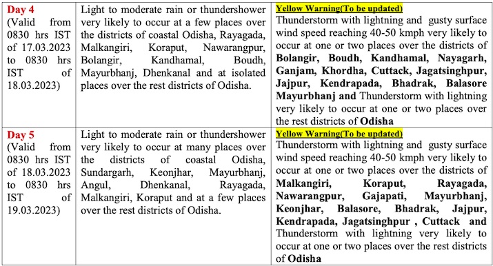
CHECK THE FORECAST
The downpour is likely to bring the temperature down.
On Monday, four places, including Bhubaneswar, had recorded 38 degree Celsius and above. Sambalpur was the hottest at 38.7 degree Celsius followed by Boudh (38.6), Malkangiri (38.5), Sonepur (38.4) and Bhubaneswar (38.2).


