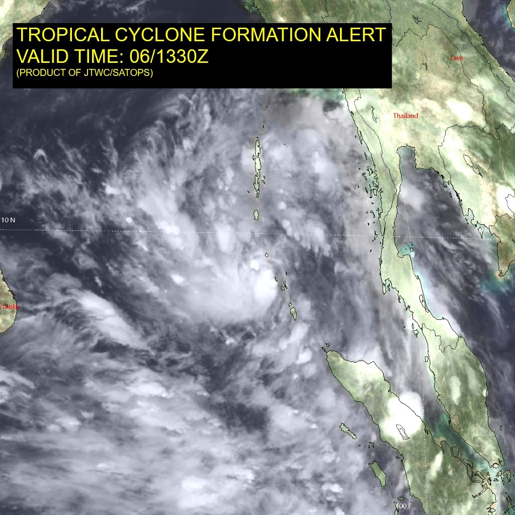
Bhubaneswar: After the India Meteorological Department (IMD), the US Joint Typhoon Warning Centre (JTWC) has also issued a Tropical Cyclone Formation Alert in the Bay of Bengal and the probability of the storm coming closer to North Andhra Pradesh and South Odisha coast is growing large.
The low-pressure area over the south Andaman Sea and adjoining southeast Bay of Bay Bengal is very likely to move northwestwards, intensify into a depression over southeast Bay of Bengal during the next 12 hours and further into a cyclonic storm over the east-central Bay of Bengal by May 8 evening, the national weather agency said on Saturday.
“This system is likely to move in the north-westwards and reach the west-central Bay of Bengal and adjoining Odisha-Andhra coast on May 10, which is 200 km away from the shore,” IMD senior scientist Umashankar Das told the media.
Its intensity and effect on Odisha are yet to be calculated, he added.
The system will be named ‘Cyclone Asani’, assigned by Sri Lanka and literally means ‘wrath’, once it intensifies into a cyclonic storm.
“While the formation of a tropical storm looks assertive, its further trajectory continues to be obscure and vague, at this point in time. More clarity and confidence await the system’s intensification to a depression, wherein the central position will become precise and decisive. The steering current dictated by the axis of subtropical anticyclone in the higher tropospheric levels is expected to be more revealing over the next 48 hours. Currently, these are the predicaments against which the cyclonic disturbance is battling over the warm waters of the Andaman Sea,” the Skymet weather agency said.
The statistical records of climatology leave a bifold trajectory for the cyclone. The first scenario: A direct strike over bordering areas of north coastal Andhra Pradesh and South Odisha.
The alternate trajectory, albeit equally strong, can make the storm recurve to run parallel to the coastline of Andhra Pradesh and Odisha and head for West Bengal and Bangladesh. In this case, the head Bay of Bengal, being relatively colder and proximity to land debilitates the storm and erodes its structure. An observation period of about 48-72 hours will be needed to announce a clear verdict, it added.
Elaborating on the spread of tracks for brewing cyclonic storm Asani in the Bay of Bengal, Senior Meteorologist Jason Nicholls said that the low-pressure area near the Andaman Islands is likely to become a depression this weekend and then a cyclonic storm early next week. “Model spread is anywhere from Chennai to Bangladesh. Ensembles centred near Odisha and West Bengal,” he added.
Paradip is the likely place shown in both European ECMWF and American GFS where the possible cyclonic storm may touch land.
Notably, the IMD has forecast heavy rainfall at one or two places over the districts of Ganjam, Khurda, Puri and Jagatsinghpur on May 10.


