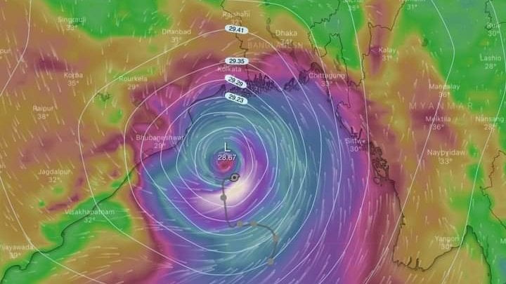
Cyclone Yaas To Reach Odisha Coast By 5.30 AM; ‘Eye’ Spotted, Know Its Unique Charateristic

Bhubaneswar: Very severe cyclonic storm Yaas is likely to reach Odisha coast by 5.30 am, 30 km east of Dhamra port, on Wednesday, IMD DG Dr Mrutyunjay Mahapatra said on Tuesday.
It will continue to move northwestwards and cross Odisha coast between north of Dhamra and south of Balasore as a very severe cyclonic with a wind speed of 155-166 km. The landfall is likely around 11 am, he added.
He said that the intensity of Yaas will be slightly less than Amphan in 2020. “This particular cyclone has a unique characteristic in the sense that it has got a large size and has been causing rainfall since yesterday. Rainfall activities continued today over coastal Odisha and squally wind has started along Odisha and West Bengal coasts. At present, wind speed is about 65-75 kmph gusting to 85 mph. It will gradually increase from midnight, particularly in Jagatsinghpur, Kendrapada and Bhadrak, touching 90 to 100 kmph,” he told India Today.
Since the storm birth took place as a Monsoon depression, it carries more intense rain-bearing clouds.
He further said that the wind speed would touch 155-165 kmph by the early hours of May 26. “This condition will prevail in Balasore, Jagatsinghpur and Kendrapada,” he said.
Meanwhile, doppler radar at Paradip has spotted the eye of Cyclone Yaas. The radius of the ‘Eye’ is said to be 35 km. Areas falling in the route of the eye suffer massive destruction.

Comments are closed.