Bhubaneswar: The cyclonic storm Dana was over north coastal Odisha, about 40 km north-northeast of Bhadrak and 70 km north-northwest of Dhamra at 11.30 am, the India Meteorological Department (IMD) informed on Friday.
It is likely to move nearly westwards across north Odisha and weaken gradually into a deep depression during the next 6 hours, it added.
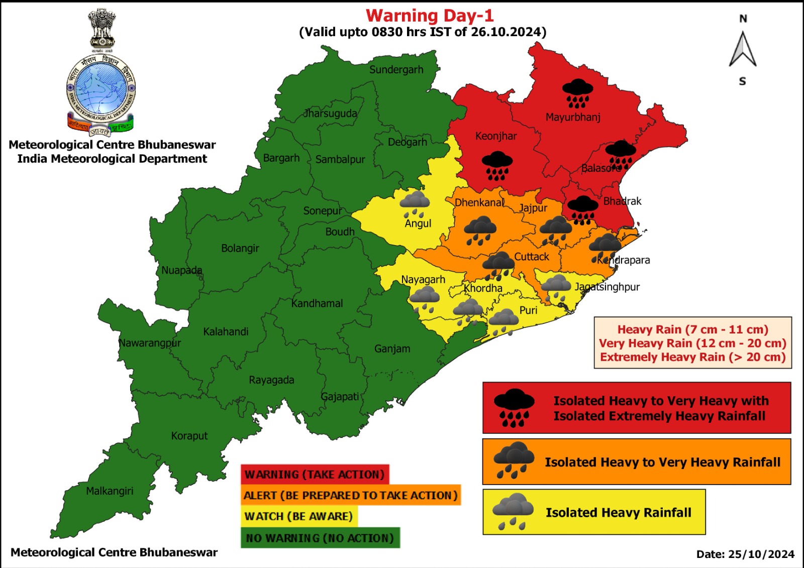
The weather agency has forecast light to moderate rainfall at most places with heavy rainfall over to very heavy rainfall at a few places in Keonjhar, Mayurbhanj, Balasore, Bhadrak, Dhenkanal, Cuttack, Jajpur, Kendrapada, Angul, Nayagarh, Khurda, Puri and Jagatsinghpur districts on October 25. Extremely heavy rainfall (≥ 21 cm) may also occur at isolated places in Keonjhar, Mayurbhanj, Balasore and Bhadrak districts.
Also Read: Puri Admn Withdraws Advisory, Ready To Welcome Tourists Post-Cyclone Dana
Red warning has been sounded for Keonjhar, Mayurbhanj, Balasore and Bhadrak, orange warning for Dhenkanal, Jajpur, Cuttack and Kendrapada and yellow warning for Angul, Nayagarh, Khurda, Puri and Jagatsinghpur.
Yellow warning of heavy rainfall continues for Mayurbhanj and Balasore on October 26.
Significant amount of rainfall in last 24 hours till 8.30 am (in cm): Chandbali (Bhadrak) 16, Rajkanika (Kendrapada) 16, Nawana (Mayurbhanj) 14, Marsaghai (Kendrapada) 11, Basudevpur (Bhadrak) 11, Oupada (Balasore) 11, Rajnagar (Kendrapada) 10, Mohakalapada (Kendrapada) 9, Aul (Kendrapada) 8, Paradip (Jagatsinghpur) 8, Derabis (Kendrapada) 7, Bhadrak (Bhadrak) 7, Balasore (Balasore) 7, Jajpur (Jajpur) 7, Kendrapada (Kendrapada) 7, Nilgiri (Balasore) 7 and Pattamundai (Kendrapada).
