Bhubaneswar: Heavy rain may resume in Odisha from July 19, the India Meteorological Department (IMD) informed on Thursday.
The monsoon trough passing through Bikaner, Datia, centre of Depression over southeast Uttar Pradesh, Dehri, Purulia, Digha and northeast Bay of Bengal is triggering rainfall activity in the state.
According to the weather agency, thunderstorm/lightning with gusty surface wind speed reaching 30-40 kmph may occur at one or two places in Sundargarh, Jharsuguda, Bargarh, Sambalpur, Deogarh, Angul, Dhenkanal, Keonjhar, Mayurbhanj, Sonepur, Boudh, Nuapada, Balangir, Kalahandi, Kandhamal, Nabarangpur, Rayagada, Koraput, Malkangiri, Ganjam, Gajapati and Balasore districts on July 17-18.
Thunderstorm activity may continue in the state for another three days amid heavy rain forecast till July 23.
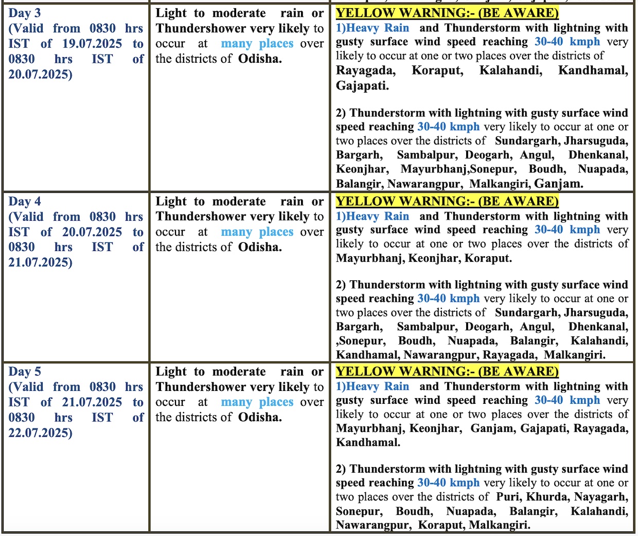
Heavy rain accompanied by thunderstorm/lightning with gusty surface wind speed reaching 30-40 kmph may occur at one or two places in Rayagada, Koraput, Kalahandi, Kandhamal and Gajapati districts on July 19; Mayurbhanj, Keonjhar and Koraput on July 20 and Mayurbhanj, Keonjhar, Ganjam, Gajapati, Rayagada and Kandhamal on July 21.
Heavy rain may continue across the state on July 22-23 with no large change during the subsequent 3 days, it added.