Lull Before Fresh ‘Low Pressure’: Rainfall Intensity In Odisha To Increase From Sept 30
Bhubaneswar: After a brief lull, the intensity of rain is likely to increase in Odisha from September 30 with the likely formation of a low pressure area over north Andaman Sea and adjoining Eastcentral Bay of Bengal, the India Meteorological Department (IMD) informed on Monday.
“A cyclonic circulation is likely to form over north Andaman Sea & neighbourhood around September 29. Under its influence, a low pressure area is likely to form over north Andaman Sea and adjoining Eastcentral Bay of Bengal during subsequent 24 hours. Thereafter, it is likely to move west-northwestwards with possibility of gradual intensification,” the weather agency said, adding that the Southwest Monsoon has withdrawn from parts of southwest Rajasthan.
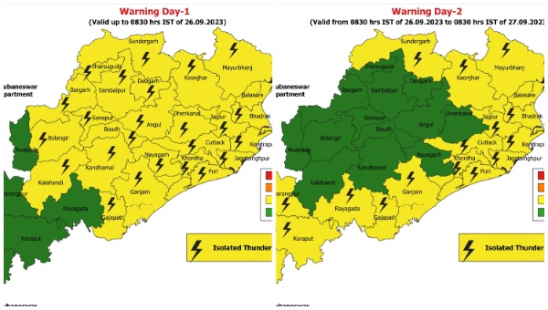
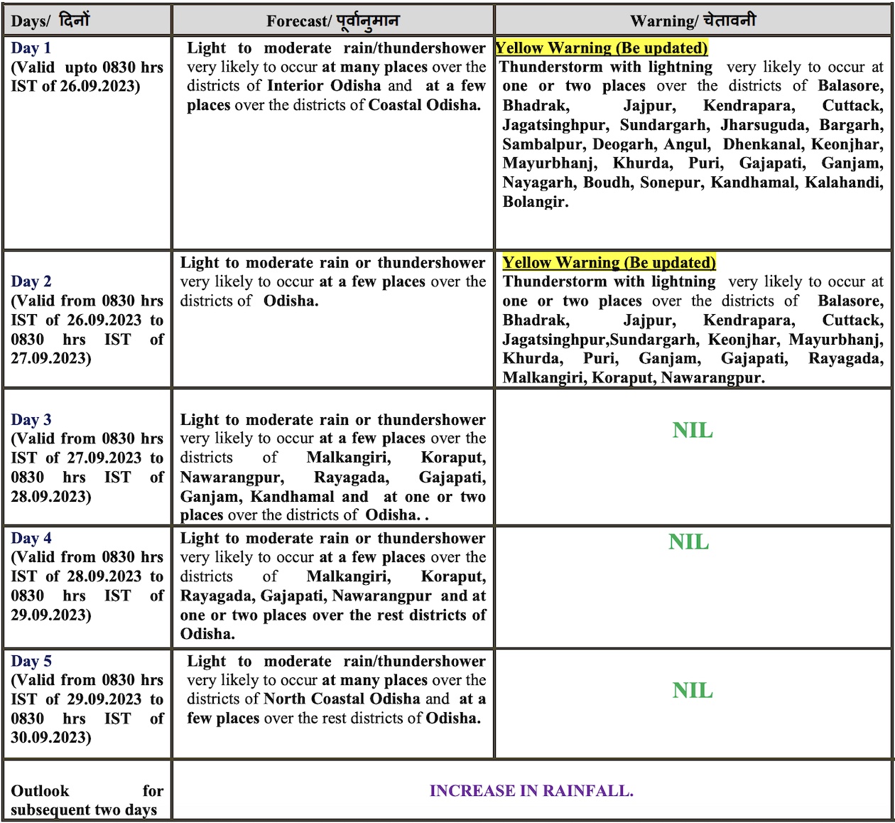
According to the midday bulletin, Odisha will continue to experience light to moderate rain for five day. Thunderstorm and lightning warning has also been issued for several districts of the state for two days.
In its extended weather outlook for Odisha issued on September 21, the IMD had forecast fairly widespread rain/thundershower from September 29-October 5. Overall rainfall activity likely to be slightly above normal with isolated heavy to very heavy rain in some districts of the state, it said.
Director of CEC at Siksha ‘O’ Anusandhan University Sarat Chandra Sahu also said the low pressure, which is expected by this month-end, may intensify into a depression or deep depression and cause widespread rain in coastal and adjoining pockets.
Comments are closed.