Bhubaneswar: Tropical Storm Noul, which made landfall in central Vietnam on Friday, is expected to bring bouts of heavy rain to Odisha and West Bengal early next week.
Though the system has lost its classification of a tropical storm, AccuWeather Senior Meteorologist and Lead International Forecaster Jason Nicholls said that it will move into India as a well-mark low pressure. “Odisha and West Bengal are likely to receive heavy rainfall on Monday and Tuesday,” he said.
Rain, some heavy, can reach as far west as Madhya Pradesh and Uttar Pradesh late Tuesday into Thursday, he added.
These areas can receive 50-100 mm (2-4 inches) of rain which may lead to flooding of areas, the report published in Accuweather said.
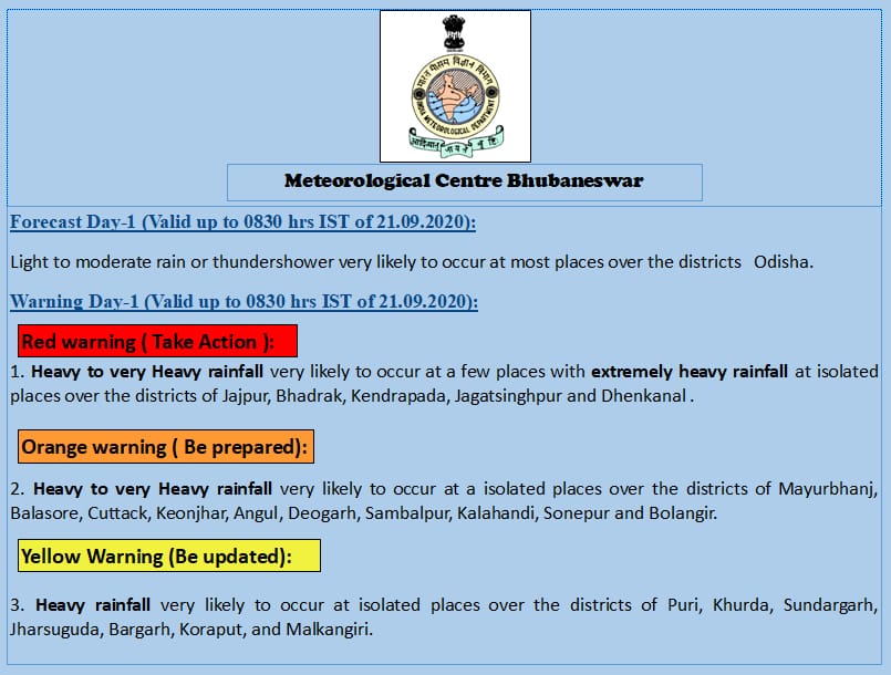
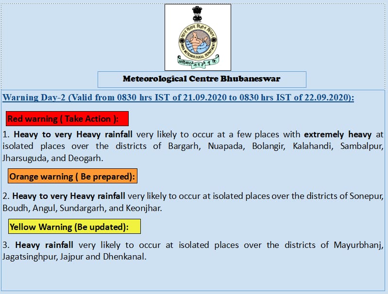
Meanwhile, the Regional Meteorological Centre here has issued flash flood warnings for several districts of Odisha in view of the low pressure area formed over the northeast Bay of Bengal and neighbourhood on Sunday.
September 20

Impact:
1. Water logging in low lying areas and localized flash flood in some areas.
2. Some damage to kutcha house and informal road.
3. Landslides in hilly areas.
4. Traffic congestion, underpass road and waterlogging in low lying areas of urban areas.
5. Damage to horticulture and standing crops in some areas due to inundation.
September 21

Impact:
1. Water logging in low lying areas and localized flash flood in some areas.
2. Possible damage to kutcha house and informal road.
3. Landslides in hilly areas.
4. Traffic congestion, underpass road and waterlogging in low-lying areas of urban areas.
5. Damage to horticulture and standing crops in some areas due to inundation.
September 22
Yellow Warning: Heavy rainfall very likely to occur at isolated places in Jharsuguda, Keonjhar and Sundargarh.


