Bhubaneswar: A cyclonic circulation is very likely to form over Westcentral & adjoining Northwest Bay of Bengal on July 24, the India Meteorological Department (IMD) informed on Sunday, adding that the system is likely to intensity into a low pressure area over the same region during subsequent 24 hours.
The weather agency further said that the cyclonic circulation over west-central & adjoining northwest Bay of Bengal is now lying over south Odisha & neighbourhood. “In view of above meteorological features, wet spell of monsoon rainfall activity over Odisha is likely to continue and it will help ongoing sowing activity of paddy crops. However, temporary waterlogging in low-lying areas and traffic congestion in urban areas, landslides in vulnerable hilly areas are likely due to heavy rain in some areas,” it said.
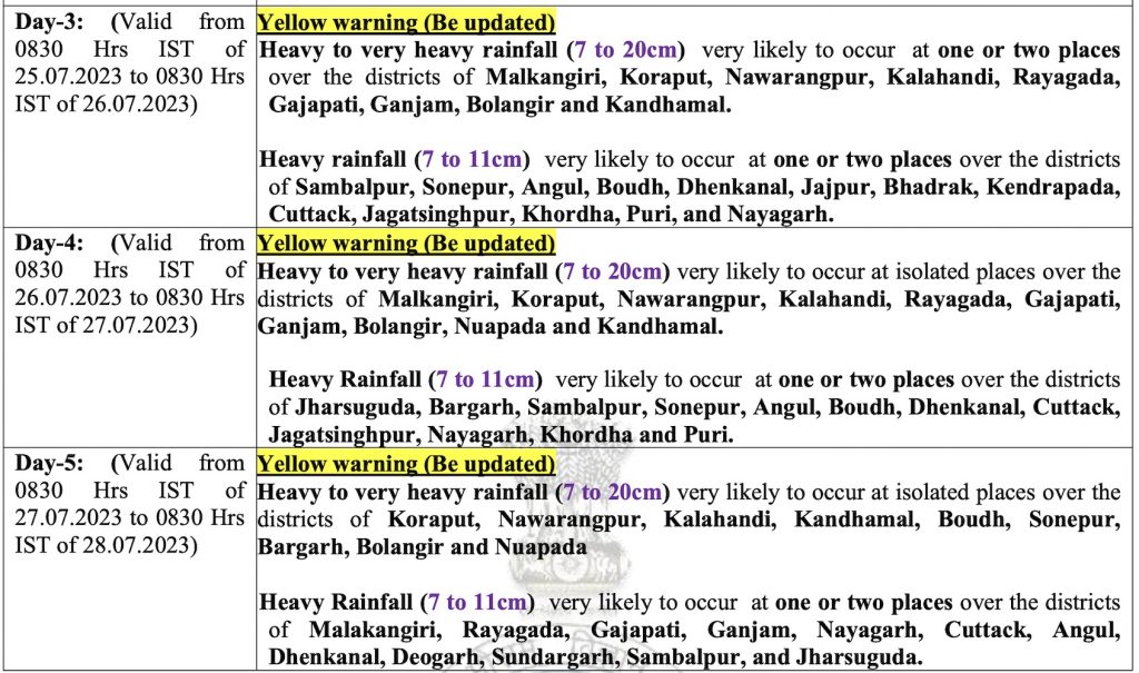
While Odisha is likely to experience heavy rain for 2 days, the intensity of falls may increase from July 25 with heavy to very heavy rain lashing several districts of the state till July 27.
The MeT office has forecast heavy rainfall (7 to 11cm) at one or two places in Malkangiri, Koraput, Nabarangpur,Kalahandi, Nuapada, Sundargarh, Keonjhar, Mayurbhanj, Angul, Deogarh, Dhenkanal, Gajapati, Rayagada, Ganjam and Kandhamal districts till 8.30 am on Monday. Heavy rainfall will continue at one or two places in Malkangiri, Koraput, Rayagada, Nabarangpur, Kalahandi, Kandhamal, Gajapati, Ganjam, Nuapada, and Balangir during the subsequent 24 hours.
VERY HEAVY RAIN FORECAST


