Bhubaneswar: The India Meteorological Department on Friday informed that the southwest monsoon had further advanced into some parts of North Arabian Sea and some more parts of south Gujarat, south Madhya Pradesh and Chattisgarh and most parts of North Bay of Bengal and more parts of West Bengal.
“Conditions are favourable for further advance of southwest monsoon into some more parts of Gujarat, Madhya Pradesh, remaining parts Chhattisgarh and Odisha, entire West Bengal, Jharkhand and Bihar and some parts of east Uttar Pradesh and remaining parts of North Bay of Bengal during next 48 hours,” it added.
The IMD’s regional centre, Bhubaneswar, also said that conditions are favorable for further advancement of southwest monsoon into the remaining parts of Odisha during the next 48 hours.
It further said that the low-pressure area now lies over Northwest Bay of Bengal and adjoining Odisha and Gangetic West Bengal coasts. A cyclonic circulation over Northwest Bay of Bengal had led to the formation of the low-pressure early this morning. It is likely to become more marked during the next 24 hours and move west-northwestwards across Odisha.
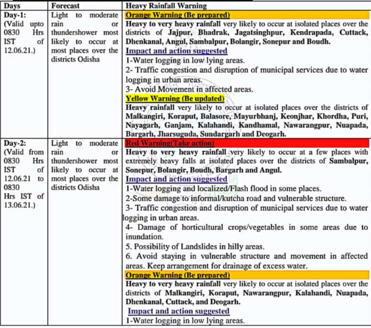
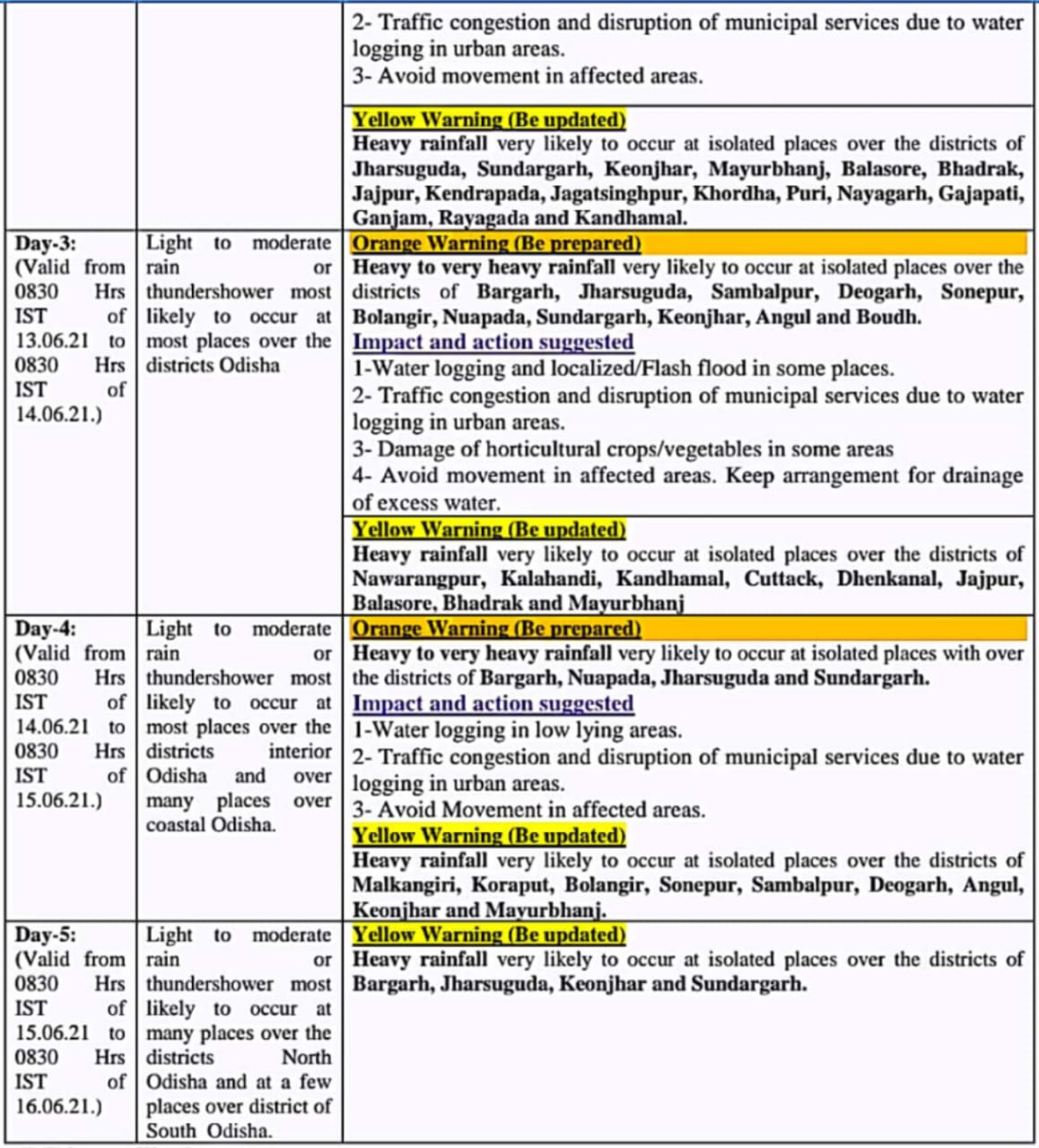
“Under its influence, fairly widespread to widespread rainfall activity with isolated to scattered heavy to very heavy falls very likely over most parts of east India and adjoining Central India from today. Isolated extremely heavy falls (20 cm) are also very likely over Odisha on Friday,” the IMD said.
Squally weather with surface wind speed reaching 35 -45 kmph gusting to 55 kmph is very likely to prevail over along and off Odisha coast and North Bay of Bengal adjoining west-central Bay Bengal till June 14.
RAIN FORECAST


