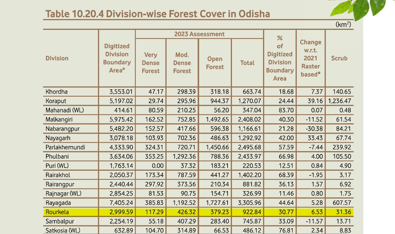
Bhubaneswar: Odisha has emerged as third among states nationally with largest gains in forest and tree cover, according to India State of Forest Report released by Union forest minister Bhupender Yadav on Saturday.
Odisha (558.57 sq km) occupies the third spot after Chhattisgarh (683.62 sq km) and Uttar Pradesh (559.19 sq km) for maximum increase in forest and tree cover. The other two states on the list are Rajasthan (394.46 sq km) and Jharkhand (289.96 sq km).
The state’s forest and tree cover climbed to 58,597.01 sq km in 2023 from 58,038.44 sq km in 2021.
With this increase, Odisha’s current forest and tree cover stands at 37.63 per cent of its total geographical area of 1,55,707 sq km. A total 33,040.47 sq km forest cover falls under recorded forest area, while the remaining 19,393.09 sq km is outside it, the report stated.
Area wise top three states having largest forest and tree cover are Madhya Pradesh (85,724 sq km) followed by Arunachal Pradesh (67,083 sq km) and Maharashtra (65,383 sq km).
Odisha also features among top three states that have shown maximum increase in forest cover. Odisha registered a growth of 151.89 sq km, with Mizoram and Gujarat taking the first and second spots with an increase of 241.73 sq km and 180.07 sq km in forest cover, respectively.
Odisha ranked second in the country for maximum increase in green cover inside recorded forest area. Mizoram was at the top position with an increase of 192.92 sq km followed by Odisha (118.17 sq km), Karnataka (93.14 sq km), West Bengal (64.79 sq km ) and Jharkhand (52.72 sq km).
Odisha is at the fourth spot with a bamboo-bearing area of 12,328 sq km. Madhya Pradesh topped the list with a maximum bamboo-bearing area of 20,421 sq km, followed by Arunachal Pradesh (18,424 sq km), and Maharashtra (13,572 sq km).
Madhya Pradesh has the maximum bamboo-bearing area of 20,421 sq km. Odisha is in the fourth spot with 12,328 sq km of bamboo area, following Arunachal Pradesh (18,424 sq km) and Maharashtra (13,572 sq km).
Odisha along with Uttarakhand and Chhattisgarh also made it to the list of states which have reported highest fire incidents in the 2023-24 season.
During the fire season 2023-24, the number of fire hotspots detected by SNPP-VIIRS sensor were 2,03, 544 as against 2,23,333 in 2021-22 seasons and 2,12,249 in 2022-23 season, it added.
Odisha has a mangrove cover of 259.06 sq km, an increase of 1.55 sq km over the previous assessment. Kendrapada has the highest mangrove cover of 212.69 sq km. Balasore also reported an increase due to natural regeneration of mangrove forest.
However, 12 districts, mostly tribal-dominated, saw a drop in their forest cover. Kalahandi led the tally with 61.94 sq km drop in its forest cover while Keonjhar recorded a 30.92 sq km drop over the two years.
Former Chief Minister Naveen Patnaik also the key findings of the report related to Odisha on X, “Glad to share that #Odisha has emerged as the leading state in increasing green cover as per the biennial, ‘India State of Forest Report 2023’ prepared by @moefcc. Odisha has emerged as third leading state in increasing in forest and tree cover (559 sq km), recorded third highest increase in forest cover (152 sq km), second leading state in increasing forest cover within FRA (118.17 sq km), and third state with growing stock in agroforestry (88.53 sq km),” he wrote.
Other findings
>> The total forest and tree cover of the country has increased by 1445.81 sq km as compared to the last assessment of 2021
>> The maximum decrease in forest and tree cover has been noticed in the state of Madhya Pradesh (612.41 sq km) followed by Karnataka (459.36 sq km), Ladakh (159.26 sq km) and Nagaland (125.22 sq km)
>> The states showing the maximum decrease of Forest Cover inside the RFA/GW are Tripura (116.90 sq km) followed by Telangana (105.87 sq km), Assam (86.66 sq km), Andhra Pradesh (83.47 sq km) and Gujarat (61.22 sq km).
>> The total Mangrove cover of the country is 4,991.68 sq km, which accounts for 0.15% of the country’s total geographical area. Among this, Very Dense Mangrove comprises 1,463.97 sq km (29.33%) of the total Mangrove cover, Moderately Dense Mangrove is 1,500.84 sq km (30.07%) while Open Mangroves constitute an area of 2,026.87 sq km (40.60%). In comparison to the 2021 assessment, there has been a net decrease of 7.43 sq km in the country’s Mangrove coverage. Gujarat has a notable decrease of 36.39 sq km. Notable increase in Mangrove forest cover is observed in Andhra Pradesh (13.01 sq km), followed by Maharashtra (12.39 sq km).
>> Arunachal Pradesh has maximum carbon stock of 1,021 Mt followed by Madhya Pradesh (608 Mt), Chhattisgarh (505 Mt) and Maharashtra (465 Mt). The per hectare carbon stock among different States/UTs indicates that Jammu & Kashmir is contributing maximum per hectare carbon stock of 174.10 t/ha, followed by Sikkim (169.20 t/ha), Himachal Pradesh (163.68 t/ha) and, Andaman & Nicobar Islands (161.62 t/ha).


