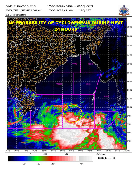
Bhubaneswar: The low-pressure area over central parts of south Bay of Bengal is likely to become well-marked on March 19 along and off Andaman and Nicobar Islands, intensify into a depression by March 20 morning and into a cyclonic storm on March 21. To move nearly north-northeastwards and reach near Bangladesh-north Myanmar coasts on March 22, the India Meteorological Department (IMD) tweeted on Thursday.
It is after almost two decades that the Indian ocean will see a storm in the month of March. If the system intensifies into a cyclonic storm, it will be called ‘Cyclone Asani’, a name is given by Sri Lanka. The name roughly translates to wrath in Sinhala. The system, however, is unlike to turn into a cyclone of high intensity.
 However, under its influence, scattered to fairly widespread rainfall is very likely over Andaman and Nicobar Islands between March 16 and March 20. Isolated heavy to very heavy rainfall is likely over the Nicobar Islands on March 19 with extremely heavy rainfall over Andaman and Nicobar Islands on March 20, it added.
Fishermen have been advised not to venture into the east central Bay of Bengal from March 21 to 23 and into the northeast Bay of Bengal from March 22 to 23.
IMD director general Mrutyunjay Mohapatra had said that the low pressure may intensify into a cyclone with a wind velocity of 70 km/hour to 90 km/hour.
The Bengal coast appears to be out of its way if the storm follows the expected trajectory, the Met office said on Wednesday evening.
Also Read: ‘Cyclone Asani’ Brewing In Bay Of Bengal: Who Named This Cyclone & What Does It Mean?
WIND MODELS
According to the Indian National Centre for Ocean Information Services (INCOIS), Bureau of Meteorology (BoM), Australia, and NCEP-GFS, the cyclonic storm is expected to make landfall in Myanmar on March 22-23. The ECMWF, however, has predicted the landfall place between Bangladesh and Myanmar. The system is also likely also weaken before the landfall.
IMPACT ON ODISHA
Though the possible cyclone is unlikely to have any impact on Odisha, it may make the weather hotter and drier. The reason: Cyclonic system drags the wind flow to sustain its heat engine. It may lead to a rise in the temperature with the northwest wind blowing into the state from March 21 onwards. The maximum daytime temperature is predicted to hover around 42-45 degree Celsius between March 23 and 29 in western and central Odisha. After a brief fall in temperature, the mercury may soar again in Bhubaneswar from March 25, according to the NCEP-GFS model.
MARCH STORMS
Since 1891, according to records available with IMD, five of seven weather systems formed had intensified into cyclonic storms. Of these, only two had hit land while the rest five fizzled out in the ocean. One of them had hit land Tamil Nadu coast in 1925. Earlier in March 1907, a similar storm hit the Sri Lanka coast.


