Bhubaneswar: Odisha is likely to experience heavy to very heavy rainfall along with thunderstorm activity till July 4 under the influence of a low-pressure area, which moved from Northwest Bay of Bengal & adjoining West Bengal and Bangladesh coasts to Gangetic West Bengal & neighbourhood on Monday.
The system is likely to move slowly west-northwestwards across North Odisha, Gangetic West Bengal & Jharkhand during the next 2 days, the India Meteorological Department (IMD) said in its midday bulletin.
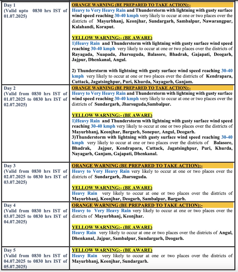
The weather agency has issued an orange warning for Mayurbhanj, Keonjhar, Sundargarh, Sambalpur, Nabarangpur, Kalahandi, Jharsuguda and Koraput till July 3, when heavy to very heavy rain and thunderstorm/lightning with gusty surface wind speed reaching 30-40 kmph may occur at one or two places in these districts.
Squally weather may also prevail with wind speed 35-45 kmph gusting to 55 kmph along & off Odisha coasts from June 30 to July 2 when sea condition is very likely to be rough to very rough. Fishermen have been advised not to venture into the sea along and off Odisha coast during this period.
The MeT office had earlier said that while the low pressure is expected to trigger heavy rain in Odisha till Tuesday, heavy rainfall activity may continue all through the week due to the active southwest monsoon.
Check Forecast For Next 5 Days


