Bhubaneswar: The regional centre of the India Meteorological Department (IMD) has forecast rainfall activity in Odisha till 8.30 am on April 5 while the ‘North Indian Ocean Extended Range Outlook’ issued by the weather agency has indicated the likely development of cyclonic circulation/low-pressure area over the southeast Bay of Bengal by April 6.
Besides most models, including IMD GFS, GEFS, NCUM, NEPS and ECMWF, the Skymet weather services said that the Bay of Bengal basin, which continues to retain its status of ‘hotspot’ for tropical cyclones, may possibly churn another storm during 1st half of April.
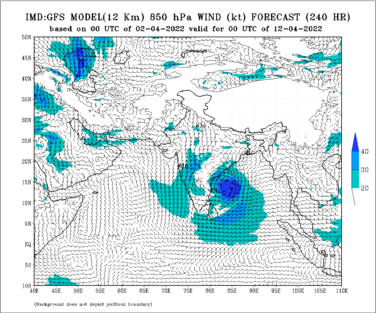
The IMD GFS model (April 2) graphically indicates the presence of a system over the Bay of Bengal and approaching the coast of India during the first half of this month.
CHECK THE RAIN FORECAST FOR THE NEXT THREE DAYS
Till 8.30 am on April 3
Light to moderate rain/thundershower is very likely to occur at one or two places in Keonjhar and Mayurbhanj districts
Between 8.30 am on April 3 and 8.30 am on April 4
Light to moderate rain/Thundershower is very likely to occur at one or two places in Keonjhar, Mayurbhanj, Balasore, Bhadrak, Kendrapara Rayagada, Gajapati, Koraput and Malkangiri
Between 8.30 am on April 4 and 8.30 am on April 5
Light to moderate rain/thundershower is very likely to occur at one or two places in North Coastal Odisha, Malkangiri, Koraput, Gajapati, Ganjam, Rayagada, Kandhamal, Mayurbhanj and Keonjhar
The MeT office further said that there will be no large change in the day temperature in Odisha during the next 4-5 days. However, the maximum temperature is likely to remain 3 to 4 degree Celsius above normal at several places in interior Odisha with the mercury soaring past 40 degree Celsius at a few places.


