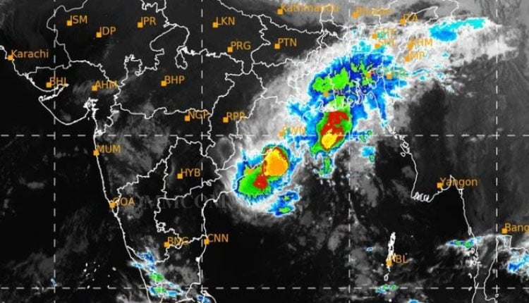
Bhubaneswar: Cyclonic storm Jawad over westcentral Bay of Bengal has moved nearly northwards with a speed of 9 kmph during past 6 hours and weakened into a deep depression, the India Meteorological Centre in its evening bulletin.
The storm lay centered over westcentral Bay of Bengal, about 180 km east-southeast of Vishakhapatnam (Andhra Pradesh), 260 km south of Gopalpur (Odisha), 330 km south-southwest of Puri (Odisha) and 420 km south-southwest of Paradip (Odisha) at 5.30 hours of Saturday.
It is likely to move north-northeast and weaken further into a depression by Sunday morning. It is likely to reach near Puri around Sunday afternoon.
Subsequently, it is likely to continue to move north-northeastwards along Odisha coast towards West Bengal coast and weaken into a well-marked low pressure area during the subsequent 24 hours.
Some areas of the coastal districts of Odisha are likely to experience rain under the influence of developing weather system tomorrow, weathermen sources said.
Orange warning of heavy to very heavy rainfall has been issued for Mayurbhanj, Balasore, Bhadrak, Kendrapada, and Jagatsinghpur from December 5-6.
Similarly, Yellow warning of heavy rainfall has been issued for the districts of Keonjhar, Angul, Dhenkanal, Cuttack, Jajpur, Khurda and Puri.
Squally winds speed reaching 45-55 kmph gusting to 65 kmph likely to prevail along and off North Andhra Pradesh–Odisha coasts during next 6 hours, stated the IMD.
It will gradually increase becoming 55-65 gusting to 75 kmph till morning of December 5 and squally winds speed reaching 50-60 kmph gusting to 70 kmph over northwest Bay of Bengal off Odisha coast from December 5 morning till afternoon. It would decrease gradually thereafter.
There is no rain prediction for December 6.
Comments are closed.