Bhubaneswar: Odisha is likely to experience heavy to very heavy rainfall accompanied by thunderstorm activity and lightning till June 20, the India Meteorological Department (IMD) informed on Monday.
The increase in rainfall activity is being attributed to cyclonic circulation, which persists over north-west Bay of Bengal and neighbourhood. Besides, the weather system is expected to assist in the further advancement of the southwest monsoon over some more parts of the state during the next 24 hours.
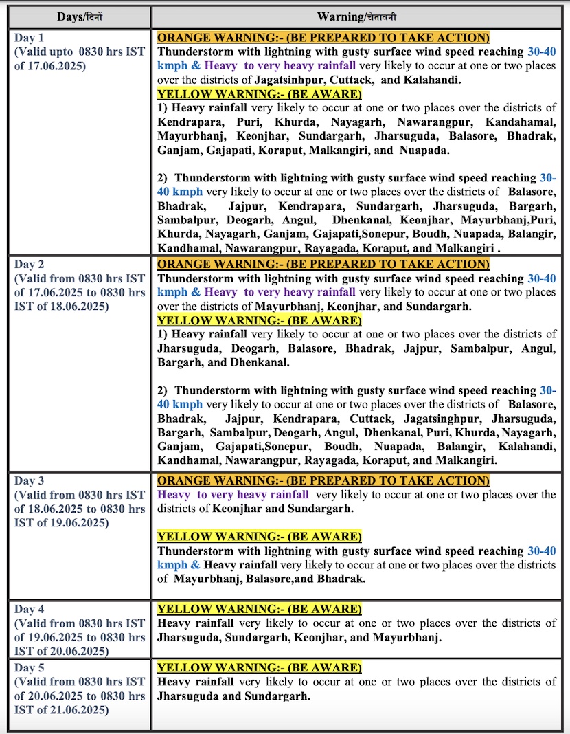
The weather agency has issued an orange warning for Sundargarh, Keonjhar, Mayurbhanj, Cuttack, Jagatsinghpur and Kalahandi for 3 days. Thunderstorm/lightning with gusty surface wind speed reaching 30-40 kmph and heavy to very heavy rainfall may at one or two places over the districts of Jagatsinghpur, Cuttack, and Kalahandi on June 16, and Mayurbhanj, Keonjhar, and Sundargarh on June 17.
During this period, the day temperature is likely to fall by 2-4 degree Celsius with no large change thereafter.
Heavy to very heavy rainfall may continue at one or two places in Keonjhar and Sundargarh on June 18.
Squally weather may prevail with wind speed 40-50 kmph gusting to 60 kmph along & off Odisha coasts From June 17-19. Fishermen have been advised not to venture into the sea along and off Odisha coast during this period.
The IMD further stated that several places in the state may witness thunderstorm activity till June 18 and heavy rain till May 20.
CHECK FORECAST FOR NEXT 5 DAYS


