One of the mysteries about the Sun Temple at Konark has to do with khondalite, the rock used to build it. There is no record of the existence of the rock within 50 km radius of the temple. So, how exactly was khondalite moved in such huge volumes, when King Narasingha Deva I of the Eastern Ganga dynasty set out to build the temple around 1250 CE?
Maybe it was shipped to the place. After all, history records that Konark was built on the Bay of Bengal beach. But geologically, there is no evidence of a palaeo-shoreline (ancient shoreline) anywhere near the temple. Any traces that might have existed have been lost and the present shoreline has moved 3 km away from the magnificent piece of Kalingan architecture.
However, near Puri, relict signatures of a palaeo-shoreline can be traced along the northern banks of marshy swamps, which were once Sar and Samang Lakes. This palaeo-shoreline, it is conjectured, based on the sequence of events, existed during late Holocene (the current geological epoch), about three-four thousand years before today.
Also, remnants of ancient Odisha maritime have been studied at Manikpatana in the southern part of Chilika lagoon. Not far from this place, there are signatures of high sea stands like beach rocks and solution features in rocks, which suggest a rise of sea level upto 6m above the present sea level during late Holocene.
But these rare geological signatures of palaeo-shorelines along the Tampara Lake, Samang and Sar lakes will be lost because of human interference, if awareness about these elements is not created in time.
And once lost, it would mean the end of possible research for posterity. UNESCO is now making a serious effort to protect such geoheritage sites.
Geoheritage
Asia, Africa and the Gulf consist of a rich geodiversity, which is regrettably not well known to the public. This is partly because of limited research undertaken in geoheritage and geoconservation in these parts of the world.
Geoheritage is commonly defined as unique components of abiotic nature that forms a part of cultural heritage stemming from the influence of geological processes or features, such as rocks, minerals, water or land forms and its non-invasive exploitation’s impact on the development, self-employment and lifestyle of the inhabitants of the region.
But thanks to efforts by UNESCO, an African Geoparks Network (AGN) was created to increase awareness among residents and decision-makers about the need for sustainable use and management of geoheritage, in particular for the benefit of local socio-economic sustainable development targets through the promotion of both geotourism and the creation of unique geoparks.
Geopark in Odisha
At a seminar on “The Conservation Of Geoheritage Sites In India: Past Present And Future Prospects”, conducted by the National Institute of Advanced Studies (NIAS) at the Indian Institute of Science campus in Bengaluru on Thursday (July 11), V Ravi Kumar and Dr B.M. Faruque, both retired directors of the Geological Survey of India, suggested, through their paper, inclusion of the Konark-Chilka-Khandagiri triangle in a geopark for conserving geoheritage. V. Ravi Kumar presented the idea of this Geopark of Odisha at the seminar in Bengaluru.
The chosen area encompasses signatures of sea level changes, coastal evolution with traces of palaeo-shorelines, a rare occurrence of cumulate anorthosite rocks (a typical lunar rock), growth of sand bar along littoral current and eventual closure of a part of Bay of Bengal, which formed the Chilika Lake.
When contacted over phone, Ravi summed up the deliberations at NIAS by saying that the delegates reached a sort of consensus on the need to frame a geo-conservation legislation, to set up a national geoconservation authority, to create a geoheritage core group in India, to find mechanism to set up geoparks and to undertake complete inventorisation of potential geosites.
“The world over, geoheritage is recognised as our heritage, which needs to be preserved for posterity,” Ravi said. “Since the last two decades, geoparks have come up around the world showcasing geoheritage, which is mainly geological heritage, and to explore develop and celebrate the links between geological heritage and all other aspects of natural cultural and intangible heritages.”
The terms geoheritage, geodiversity, geoconservation, he further said, are all related and are answered through establishment of geoparks. “It is pertinent that India, with a vast geoheritage, should take geoheritage and geoconservation (Protection of Sites) to the public, explaining the earth’s journey in 4,600 million years.”
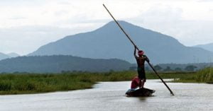
Lake Chilika
 Giving an example of how interesting geological evidence get lost, Dr Faruque cited how, in 2001, he had taken a photograph of red sediments near Chilika Lake – evidence of the existence of arid climate in the past (14,000 years before present) during Last Glacial Maxima. “When I revisited the place in 2009, a bus stand stood in its place. That geological evidence is irretrievably gone,” Dr Faruque lamented.
African connection
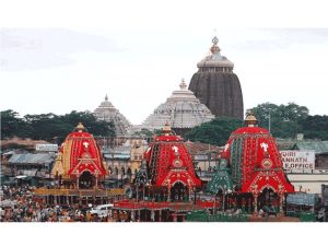
Similarly, Jagannath Temple and the finely and ornately carved Udayagiri and Khandagiri caves, were built in the second century with Athgarh sandstone, a rock formed when India and Africa (Karoo sandstone) constituted part of the Gondwanaland, before the continental drift tore India from Africa and placed it on the Equator.
Moonstruck
As one drives from Manikpatana, Tampara Lake and Aryapalli along the highway NH-16, one finds the outcrops of Anorthosite, a monomineralic rock, just after crossing Balugaon. This rock is rare on Earth but common on the Moon. They keep using rocks to build roads. Soon it could be the end of the road for this moon link. The highway NH-16 passes through the Balugaon Anorthosite occurrence.


