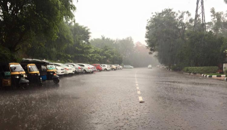
Bhubaneswar: Odisha is bracing up for a series of cyclonic circulations over the Bay of Bengal which are likely to trigger heavy rains across the state during the next 10 days.
“Numerical models indicate that a series of low pressure areas – all remnants of South China Sea systems – were likely to form over the bay in the next few days,” said Dr Sarat Chandra Sahu, Director of SOA’s Centre for Environment and Climate.
The cyclonic circulations were moving westwards from the South China Sea to the Bay of Bengal through Myanmar and Thailand. One of such cyclonic circulation presently lay over north-west Bay and could cause moderate to heavy rainfall from Sunday till September 23.
Under the impact of the cyclonic circulations, most parts of Odisha are likely to receive heavy rainfall between September 20 and 22 including the districts of Bhadrak, Kendrapada, Puri, Jagatsinghpur, Khurda, Cuttack, Keonjhar, Mayurbhanj, Jajpur, Sundargarh, Sonepur, Boudh, Deogarh, Sambalpur, Bargarh, Balangir, Kandhamal, Dhenkanal and Angul, said Dr Sahu.
One more cyclonic circulation may surface on September 24 followed by formation of low pressure area on September 25 and depression on September 26 over the north-west Bay. It could cause heavy precipitation on September 26 and 27 over coastal and adjoining districts. This system may cross north Odisha coast over Bhadrak district, he said.
Yet another cyclonic circulation could develop on September 26 over north-east bay and might turn into a low pressure area on September 28. It will trigger heavy rainfall in coastal and adjoining districts between September 28 and 30 and was likely to cross the Balasore coast as a depression on September 29. It could lead to a flood like situation, he said.
Earlier, the India Meteorological Department had predicted two cyclonic circulations.
The IMD had predicted that the cyclone (from September 19 to 21) will not bring much rains as it will not concentrate into a depression. It will pass through north Odisha via Sundargarh as low pressure and move towards Chhattisgarh under the impact of which rains are expected in some parts of the state till September 20, the IMD had stated.
The second cyclonic circulation from from September 24 to 30 is likely to move west-northwestwards and cause a fresh spell of rainfall activity over east and central India commencing from September 25 for the subsequent 4-5 days, the IMD added.
Also Read: Cyclonic Circulation Nears Odisha Coast: Heavy Rainfall To Lash 18 Districts Today
Comments are closed.