Possibility Of Severe Cyclonic Storm, Says IMD; But Clearer Picture After It Develops Into Depression; Check Latest Updates

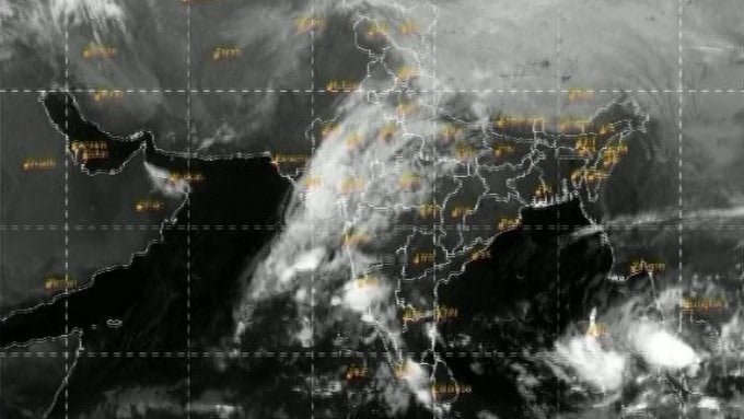
Bhubaneswar: India Meteorological Department (IMD) Director General (DG) Mrutyunjay Mohapatra on Wednesday said a clearer picture of the path, intensity and landfall region will emerge once the low pressure, now churning over the south Andaman Sea and adjoining region, intensifies into a cyclone.
“Aspects of the system like intensity and probable region of landfall can be ascertained in the best manner after it develops into a depression,” he said.
The low pressure is likely to intensify into Cyclone Jawad by December 3.
“There is every possibility that it may take the shape of a Severe Cyclonic Storm,” Mohapatra said, adding that no immediate warning has been issued to ports.
“The low pressure over south Thailand and neighbourhood has emerged into central Andaman sea. It persisted over the same region at 8:30 am today. It’s likely to move west-northwestwards and concentrate into a depression over southeast and adjoining east-central Bay of Bengal by tomorrow, and intensify into a cyclonic storm over central parts of the Bay of Bengal during the subsequent 24 hours. Subsequently, it’s likely to move northwestwards, intensify further and reach near north Andhra Pradesh-Odisha coasts around December 4 morning,” the IMD said in its mid-day bulletin today.

An IMD-Global Forecast System (GFS) model has indicated an Extremely Severe Cyclonic Storm (ESCS) hitting Odisha’s coast on December 4. Here’s how the model has plotted the cyclone’s path:
* Dec 3, 11:30 pm
Over west-central and adjoining north-west Bay of Bengal off north Andhra Pradesh-south Odisha coasts
* Dec 4, 5:30 am
Over north-west and adjoining west-central Bay of Bengal
* Dec 4, 11:30 am
Close to south Odisha coast
The model indicated further northeastward movement of the system along the coasts of Odisha and West Bengal with gradual weakening up to 5:30 pm on December 6.
The IMD has said the intensity of rainfall in Odisha will increase from December 4, especially coastal and interior districts will experience heavy to very heavy rainfall. Some parts of coastal Odisha will experience extremely heavy rainfall (20 cm or above) during the period.
However, the intensity of rainfall will decrease from December 5.
Wind warning
Squally winds reaching 50-60 kmph gusting to 70 kmph over southeast and adjoining east-central Bay of Bengal on December 2. Gale winds reaching 65-75 kmph gusting to 85 kmph likely over central Bay of Bengal from December 3 morning and, and then reaching 90-100 kmph gusting to 110 kmph over northwest and adjoining west-central Bay of Bengal from December 4 morning for subsequent 24 hours.
Squally winds reaching 45-55 kmph gusting to 65 kmph likely along and off north Andhra Pradesh-Odisha coasts from December 3 midnight and winds reaching 70-80 kmph gusting to 90 kmph from December 4 morning for subsequent 12 hours.
Sea conditions
Sea condition would become very rough to high over southeast and adjoining east-central Bay of Bengal on December 2. Sea condition would be high over central Bay of Bengal on December 3 and high to very high over west-central and northwest Bay of Bengal from December 4 morning for subsequent 24 hours.
Sea condition will be rough to very rough over, along and off north Andhra Pradesh-Odisha coast from midnight of December 3 and become high to very high from December 4 afternoon for the subsequent 12 hours.
Fishermen warning
Fishermen are advised not to venture into southeast and adjoining east-central Bay of Bengal on December 2 and 3, west-central and adjoining northwest Bay of Bengal and along and off north Andhra Pradesh-Odisha-West Bengal coasts during December 3-5.

Comments are closed.