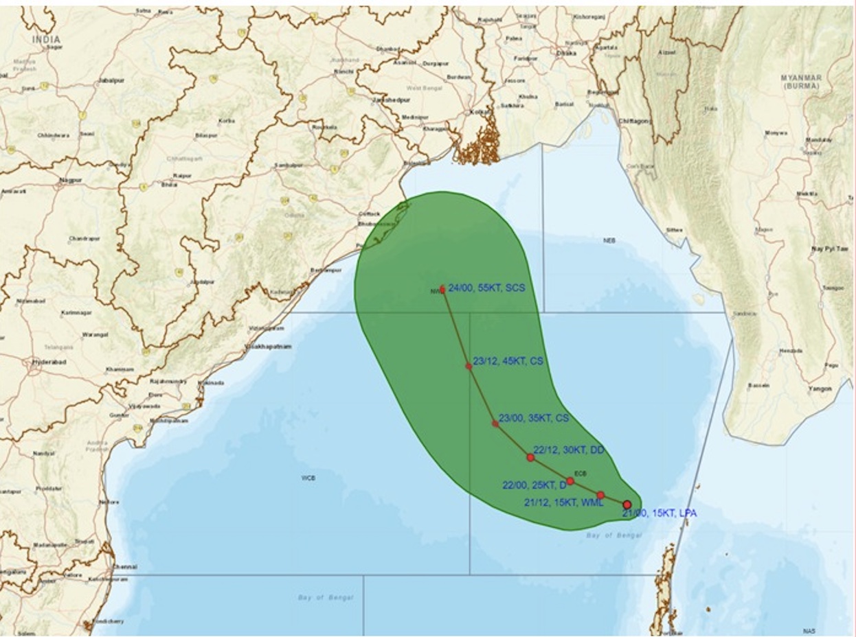
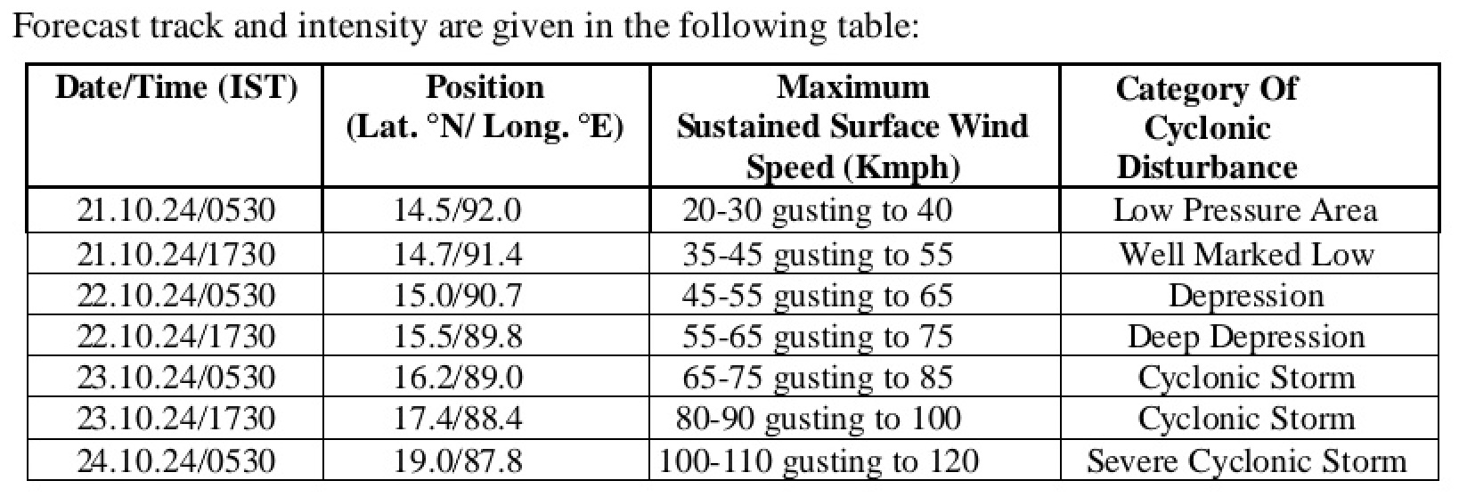
Bhubaneswar: The India Meteorological Department (IMD) on Monday forecast the track and anticipated wind speed and intensity of the possible cyclone ‘Dana’ brewing over Bay of Bengal.
‘Dana’ is likely to make landfall as a severe cyclonic storm with a wind speed of 100-110 kmph gusting to 120 kmph on October 24. Odisha is likely to the maximum brunt of this storm. Weather models had earlier indicated that the cyclone may cross the coast near Puri or Bhubaneswar around October 24-25.
Also Read: Cyclone ‘Dana’ May Cross Odisha Coast Near Puri Or Bhubaneswar; Know What Weather Models Indicate


In its morning bulletin, the IMD had informed about formation of a low-pressure area over Eastcentral Bay of Bengal and adjoining north Andaman Sea at around 5.30 am. “It is very likely to move west-northwestwards and intensify into a depression by October 22 morning and into a cyclonic storm by October 23 over Eastcentral Bay of Bengal. Thereafter, it is very likely to move northwestwards and reach northwest Bay of Bengal off Odisha-West Bengal coasts by October 24 morning,” it said.
Also Read: IMD Issues Red Warning Of Very Heavy Rain As Odisha Braces For Cyclone ‘Dana’
Light to moderate rainfall at most places with heavy rainfall at isolated places may occur in Odisha on October 23 and heavy to very heavy rainfall at a few places with extremely heavy rainfall at isolated places on October 24-25, it added.
Meanwhile a 24×7 Control Room has been opened at Special Relief Commissioner’s Office here. Senior IAS officers will be deputed to districts likely to be affected by the cyclone. NDRF, ODRAF and Fire Services personnel will be moving to Balasore, Bhadrak, Jagatsinghpur, Puri, Ganjam and Gajapati districts this evening, sources said.
Also Read: Odisha To Face Brunt Of Possible Cyclone ‘Dana’, Wind Speed@100-120 Kmph By Oct 24: IMD DG


