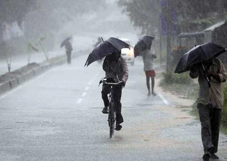
Bhubaneswar: While the depression has weakened into a well-marked low-pressure area (LOPAR) over southeast Madhya Pradesh and its neighbourhood, Odisha will continue to experience heavy rainfall for the next 3 days, India Meteorological Department (IMD) informed on Monday.

“The depression over south Chhattisgarh and adjoining southeast Madhya Pradesh and Vidarbha weakened into a well-marked low-pressure area and moved away further northwestward. It is likely to move nearly northwestwards across Madhya Pradesh during the next 48 hours and west-northwestwards across south Odisha and south Chhattisgarh during the next 24 hours and weaken gradually,” the MeT office said in its midday bulletin.
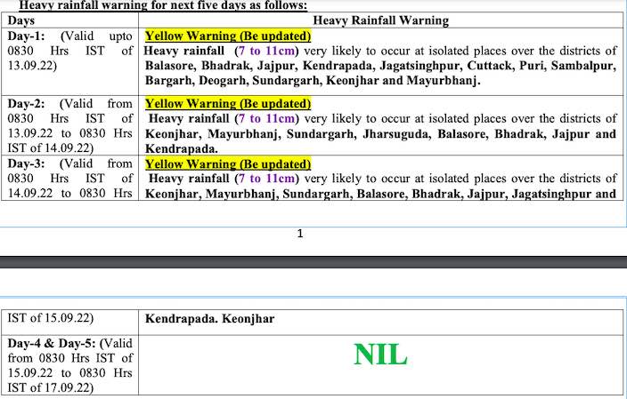
A yellow warning for heavy rainfall (7 to 11 cm) has been issued for several districts of Odisha till 8.30 am on September 15.
Till Tuesday morning, heavy rain is likely to lash isolated places in Balasore, Bhadrak, Jajpur, Kendrapada, Jagatsinghpur, Cuttack, Puri, Sambalpur, Bargarh, Deogarh, Sundargarh, Keonjhar and Mayurbhanj, while Keonjhar, Mayurbhanj, Sundargarh, Jharsuguda, Balasore, Bhadrak, Jajpur and Kendrapada are likely to experience some intense spells during the subsequent 24 hours.
Check the forecast here:
Due to the strong monsoon current squally weather with gusty surface wind speed reaching 40 to 50kmph is also likely along & off Odisha coast adjoining northwest Bay of Bengal during the next 48 hours. Fishermen have been advised against venturing into the sea during this period.
Comments are closed.