March Storm: Possible Cyclone In Bay of Bengal; Know What Experts & Weather Models Have To Say

Bhubaneswar: The India Meteorological Department’s (IMD) prediction about the formation of a low-pressure over Equatorial Indian Ocean and adjoining Southwest Bay of Bengal during the next 24 hours has put the focus on the possibility of a March storm this year.
While IMD Director General (DG) Mrutyunjay Mohapatra clarified that it was too early for the agency to say whether the low pressure would intensify into a cyclone, senior scientist Umasankar Das attribute it to a cyclonic circulation that formed over the central part of south Bay of Bengal and the adjoining area over Equatorial Indian Ocean around March 10 and subsequently became active.
Das added that the low-pressure will have no impact on Odisha for the next seven days.
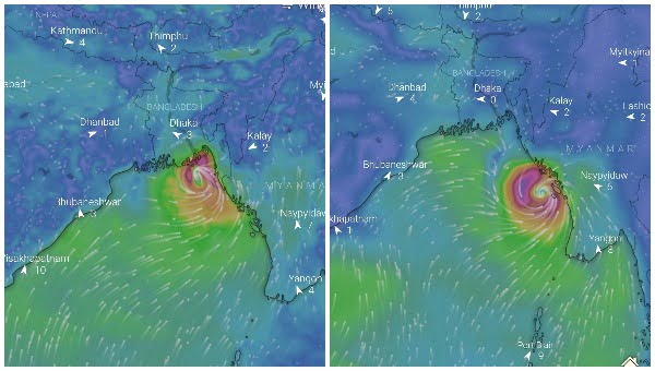
However, some weather experts are of the opinion that the system would move northwards and then northwestward. “It may change its path towards north-northeastwards direction while being around 200 km away from Odisha coast and head towards Bangladesh,” Director of the Centre for Environment and Climate of SOA University, Sarat Chandra Sahu was quoted as saying.
While the European ECMWF model shows possible landfall in Bangladesh, the system is seen moving towards the Myanmar coast according to the American GFS model.
Notably, only 5 cyclones have formed between 1900 and 2021 and of these, none made landfall over land as a storm.
Also Read: Low-Pressure Over Bay In 24 Hours; Know How Frequent Are March Storms

Comments are closed.