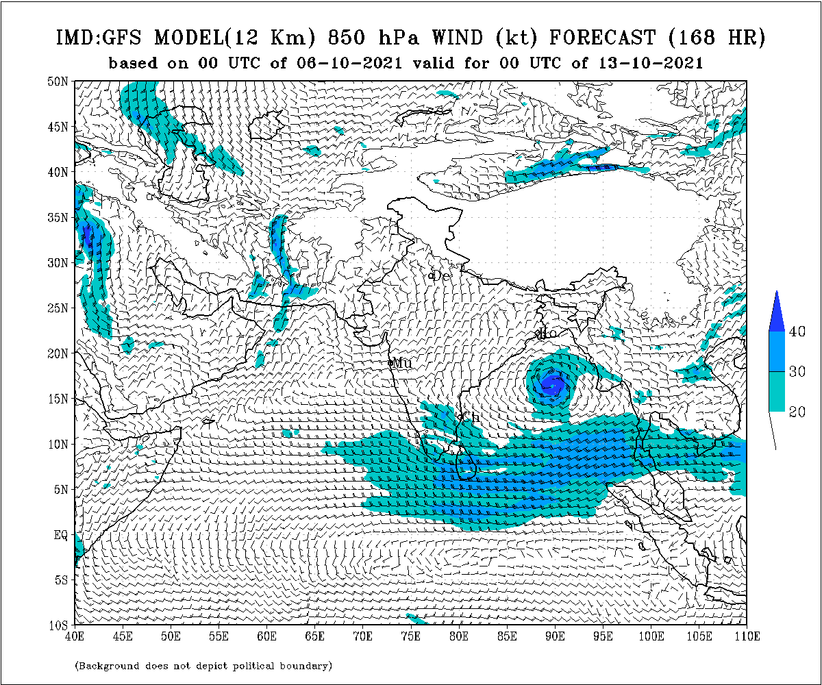
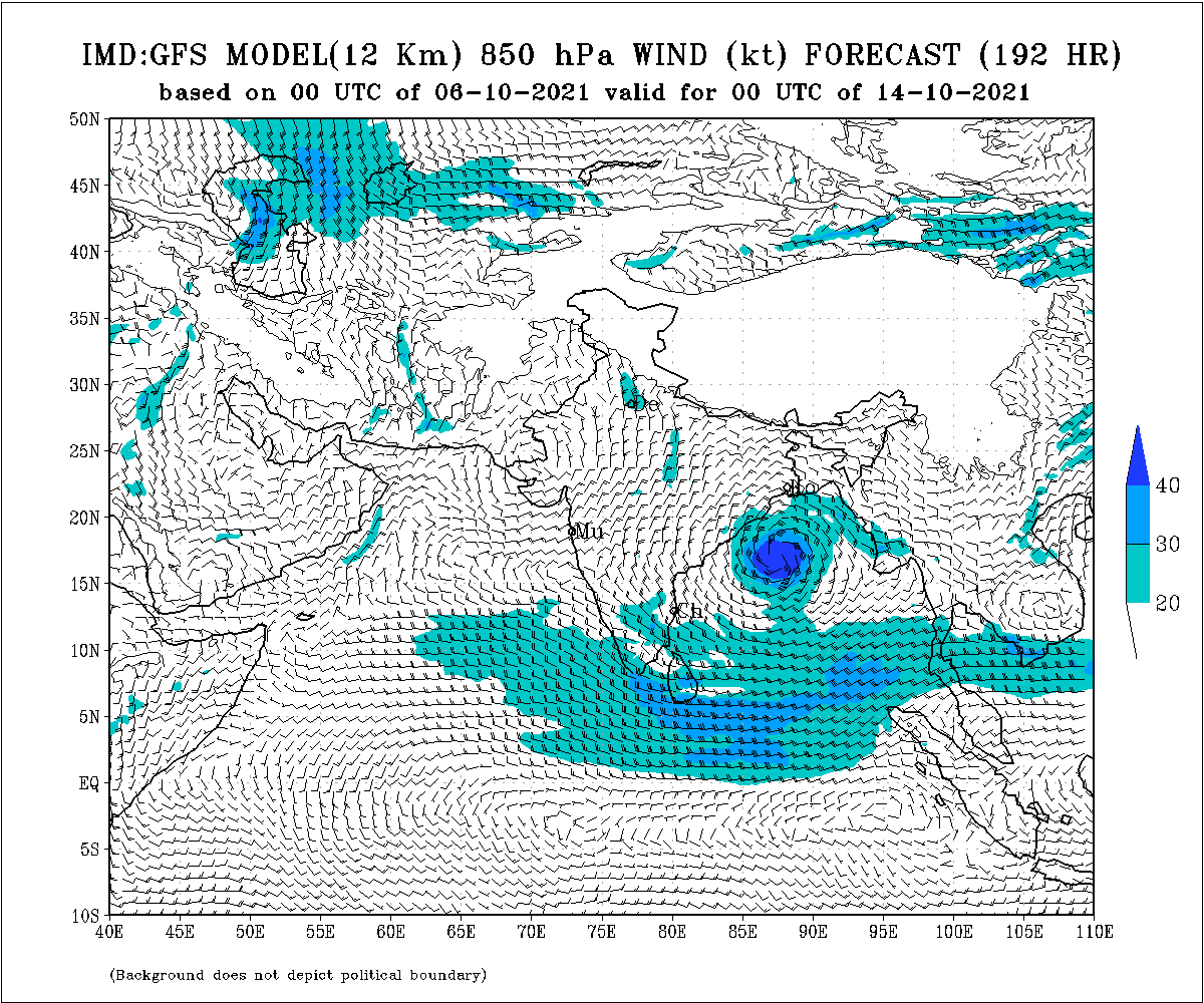
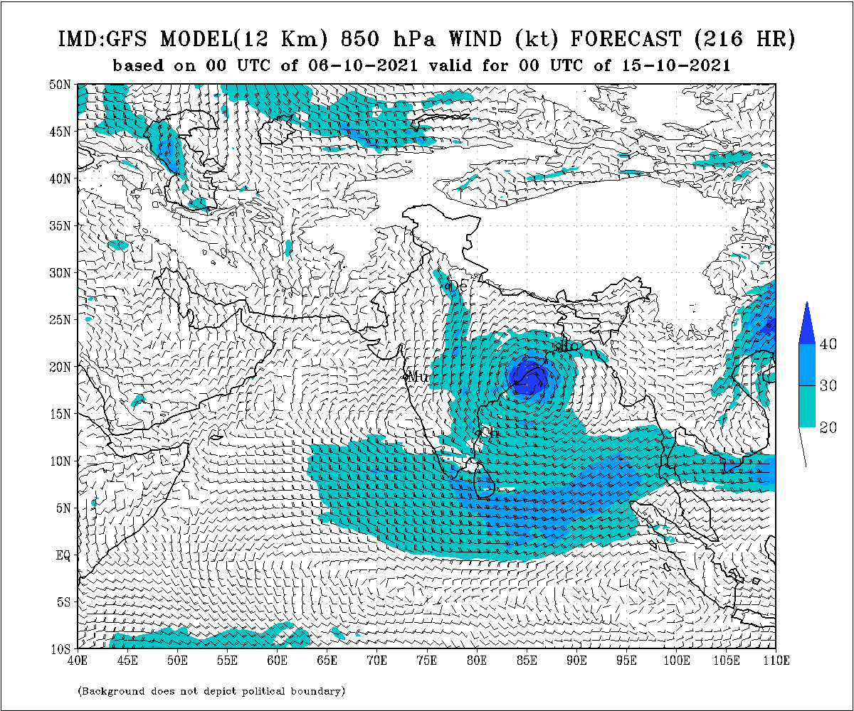
Bhubaneswar: A fresh low pressure is likely to form over the North Andaman sea around October 10. It will further intensify into a cyclone and move towards Odisha, crossing the coast between Paradip and Gopalpur around October 14-15, according to a GFS model of Tropical Tidbits.
According to the IMD’s Wednesday mid-day bulletin, a low-pressure area is very likely to form over the north Andaman Sea around October 10. It is likely to become more marked and move west-northwestwards towards South Odisha and North Coastal Andhra Pradesh coast during subsequent 4-5 days.
The IMD-GFS model also shows the formation of a system over the Bay of Bengal around October 12 and it is likely to cross Odisha-Andhra Pradesh coasts around October 15.

According to the NCEP-GFS forecast, the developed system will intensify into a cyclone by October 16 and may cross the coast between Srikakulam (Andhra Pradesh) and Gopalpur (Odisha) coast on and around October 17.
The ECMWF model indicates that the system may approach Visakhapatnam-Kakinada coasts around October 15.
If the system intensifies into a cyclonic storm, it will be named Cyclone Jawad.
This system is likely to bring very heavy rains to coastal districts of Ganjam, Puri, Khordha, Jagatsinghpur, Kendrapada and the southern districts of Gajapati and Rayagada, the models added.
Notably, October is considered a cyclone month for Odisha – Super Cyclone (October 29, 1999), Phailin (October 12, 2013) and Titli (October 11, 2018).
#CycloneAlert A fress low pressure likely to form over North Andaman sea around 10th Oct. & Will further intensified to a #cyclone & move towards #Odisha, likely to cross b/w #Paradip to #Gopalpur around 14-15th Oct.(GFS)
Phailin – 12th 2013 Oct.
SuperCyclone- 29th 1999 Oct. pic.twitter.com/r2MhyDRPwu— Sitam Moharana_ANI (@SitamMoharana) October 6, 2021


