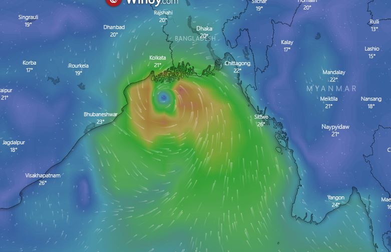
Bhubaneswar: The well-marked low pressure over is likely to move west-northwestwards and concentrate into a depression over southeast and adjoining east-central Bay of Bengal within the next 12 hours, the India Meteorological Department (IMD) said on Thursday.
At around 5:30 am, the tropical disturbance entered the southeast Bay of Bengal and the system is currently 1419 km away from Visakhapatnam (Andhra Pradesh) and around 1442 km away from Gopalpur in Odisha. It is moving at a speed of 35 km/hr.
The system is likely to intensify into a cyclonic storm JAWAD over central parts of the Bay of Bengal during the subsequent 24 hours. It is likely to move northwestwards, intensify further and reach near north Andhra Pradesh – Odisha coasts on December 4 morning.
Also Read: Cyclone Jawad To Reach Odisha Coast By Dec 4; Who Proposed This Name & What It Means
According to the IMD-GFS model, the cyclone is likely to make landfall between Srikakulam district in Andhra Pradesh and Puri district in Odisha. The system will then curve along the Odisha coastline to move into West Bengal after the landfall.
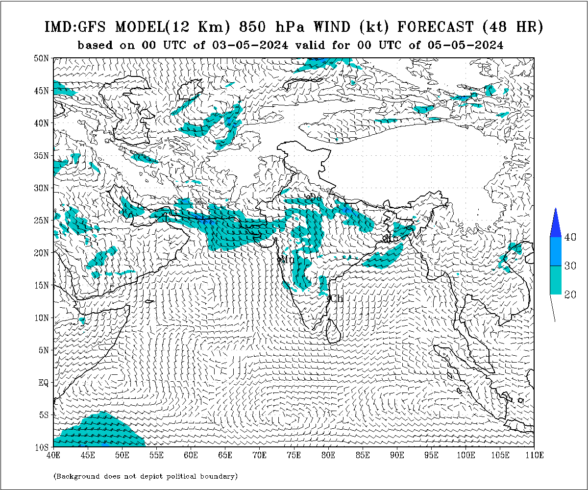
The ECMWF, ACCESS-G3 and INCOIS have also made similar predictions.
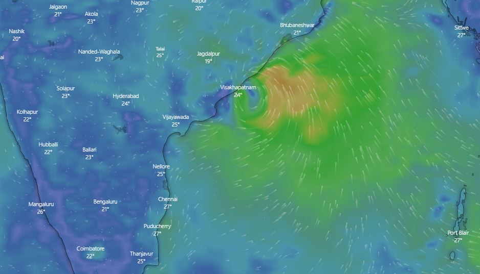
As a result, the coastal and north Odisha districts are likely to experience a sustained wind speed of around 40kmph till December 5 (Sunday) morning. Extremely heavy rain is expected to lash the districts between Gajapati to Puri.
According to senior meteorologist Jason Nicholls, the low pressure near the Andaman Islands will become a cyclonic storm over the Bay of Bengal in the next couple of days. The storm will spread heavy rain, risk of flooding and gusty winds from the north coast of Andhra Pradesh to Odisha, WestBengal and Bangladesh later Friday through Sunday.
Also Read: Cyclone Jawad: ECoR Cancels 95 Trains For Two Days
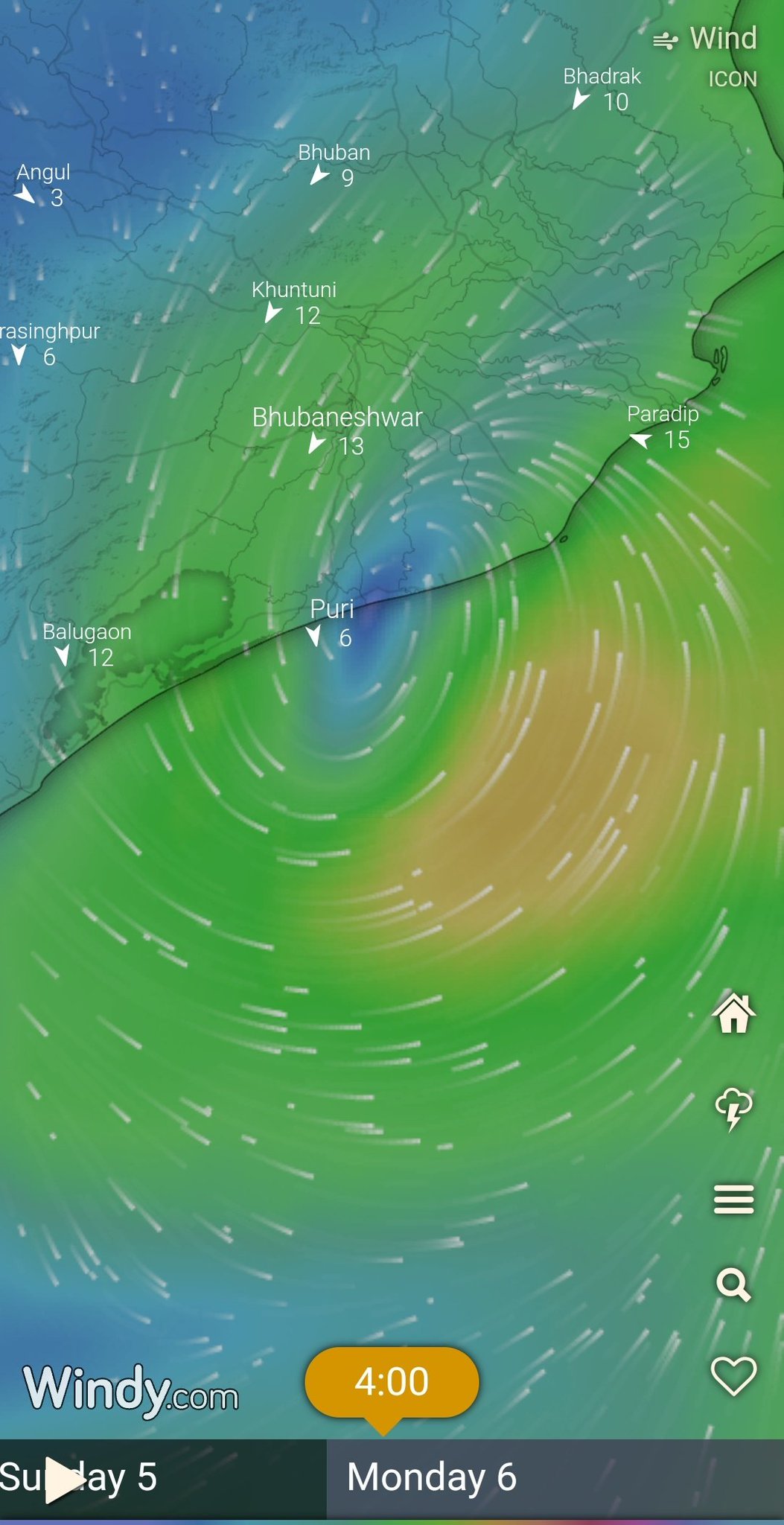
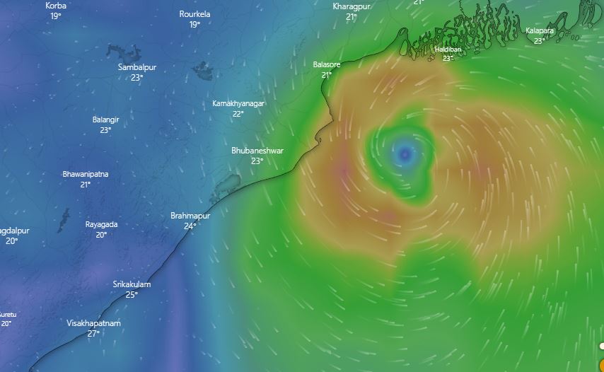
German Weather Service ICON (Icosahedral Nonhydrostatic) model shows that the cyclone will move close to the Odisha coast and make landfall near Puri.
According to the American GFS model, the cyclone might skirt Odisha and make landfall in adjoining West Bengal and Bangladesh.
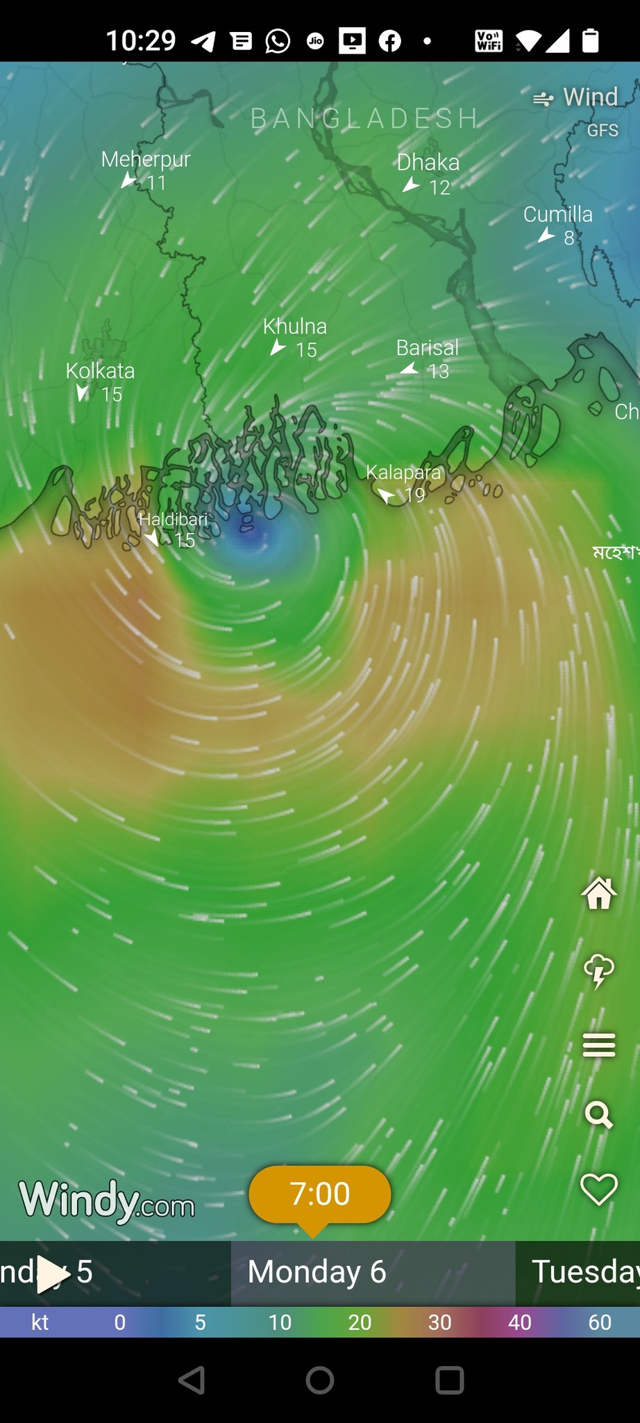
The Windy GFS model also shows the likely landfall between Balasore and Kolkata.
Also Read: Cyclone Update: Depression To Form Today, Severe Cyclonic Storm Likely, Says IMD; Check Details
“Wind speed is likely to be around 100 kmph and there is less likelihood of it getting higher. There will be clarity on cyclone path after system develops into a depression,” said IMD DG Mrutyunjay Mohapatra.


