Bhubaneswar: The low-pressure area over Bay of Bengal has become well marked and is expected to intensify further into a Depression during the next 24 hours, the India Meteorological Department (IMD) informed in its Monday morning bulletin.
“The low-pressure area over north Bay of Bengal & adjoining coastal areas of Bangladesh, West Bengal & north Odisha moved northnorthwestwards and lay as a well-marked low-pressure area over southwest Bangladesh and adjoining Gangetic West Bengal at 5.30 am on July 14. It is likely to move northwestwards and concentrate into a Depression during the next 24 hours.”
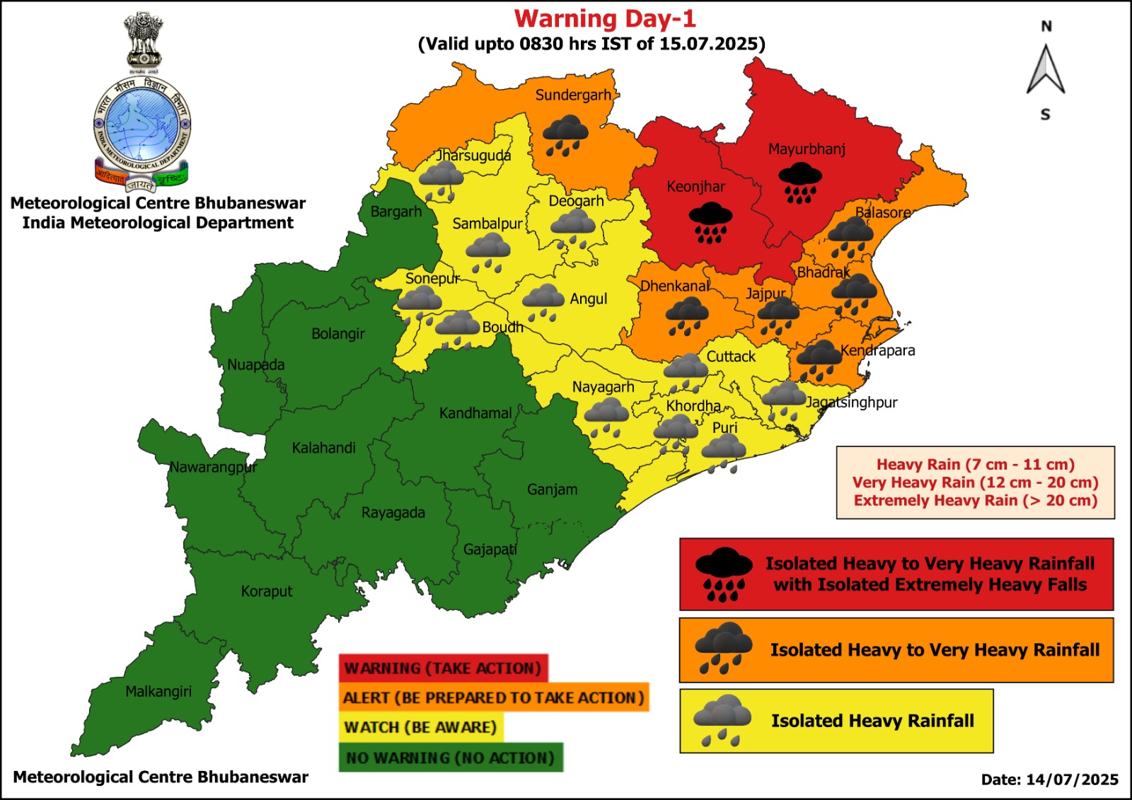
The system is likely to trigger very heavy rain in Odisha during these 24 hours.
The IMD has issued a red warning for two districts, Mayurbhanj and Keonjhar, which may experience extremely heavy spells of rain (>20 cm) on July 14. Orange warning of heavy to very heavy rainfall has been sounded for Dhenkanal, Jajpur, Bhadrak, Balasore, Kendrapada and Sundargarh. Isolated heavy rainfall may also occur in Jharsuguda, Sambalpur, Sonepur, Angul, Boudh, Deogarh, Nayagarh, Cuttack, Khurda, Puri and Jagatsinghpur districts.
The weather agency has warned of localised flooding, landslides, damage to standing crops and kutcha houses, disruption of traffic and inland water transport due to waterlogging and poor visibility.


