Bhubaneswar: The India Meteorological Department has forecast formation of a low pressure area over Bay of Bengal during Durga Puja celebrations.
According to the MeT office, one low-pressure area each over the Arabian Sea and the Bay of Bengal is expected to form after October 19. The system over the Bay of Bengal, however, is not expected to cross Odisha.
“A cyclonic circulation is likely to form over southeast Bay of Bengal and adjoining Andaman Sea between October 19 and 22. Under its influence, a low pressure area is likely to form over south and adjoining central Bay of Bengal. It is likely to move westwards towards North Tamil Nadu and Andhra Pradesh coasts with low probability of further intensification into depression over southwest and adjoining westcentral Bay of Bengal,” the IMD said in its extended range outlook.
Notably, Odisha has started preparations for a possible calamity since weather conditions become favourable for cyclones in the Bay of Bengal within 45 days from the departure of monsoon. The months of October and November are usually considered the “cyclone period”.
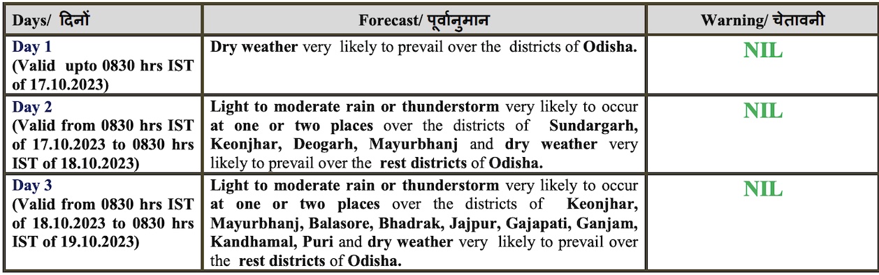
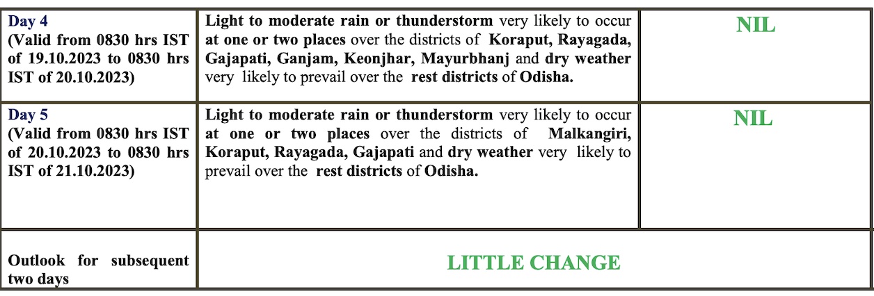
Meanwhile, the weather agency has predicted light to moderate rain in some parts of the state, which has been experiencing hot weather conditions, from Tuesday (October 17). There will also be no large change in the maximum and minimum temperature across the state during the next 5 days.
The IMD also informed that the cyclonic circulation over Southeast Arabian Sea and adjoining Lakshadweep area may develop into a low-pressure area over southeast and adjoining eastcentral Arabian sea during next 48 hours. It is likely to move further west-northwestwards and intensify into a depression over central Arabian sea around October 21. “The cyclonic circulation over coastal Tamil Nadu & neighbourhood persists while another lies over Northeast Bay of Bengal,” it added.


