Bhubaneswar: The India Meteorological Department (IMD) on Tuesday warned of isolated heavy to very heavy rainfall with extremely heavy rainfall and thunderstorm activity in Odisha till June 20.
The state is likely to witness enhanced rainfall activity under the influence of a low-pressure area over southwest Bangladesh and adjoining Gangetic West Bengal, which is likely to move slowly west-northwestwards and become more marked over Gangetic West Bengal and neighbourhood during the next 24 hours.
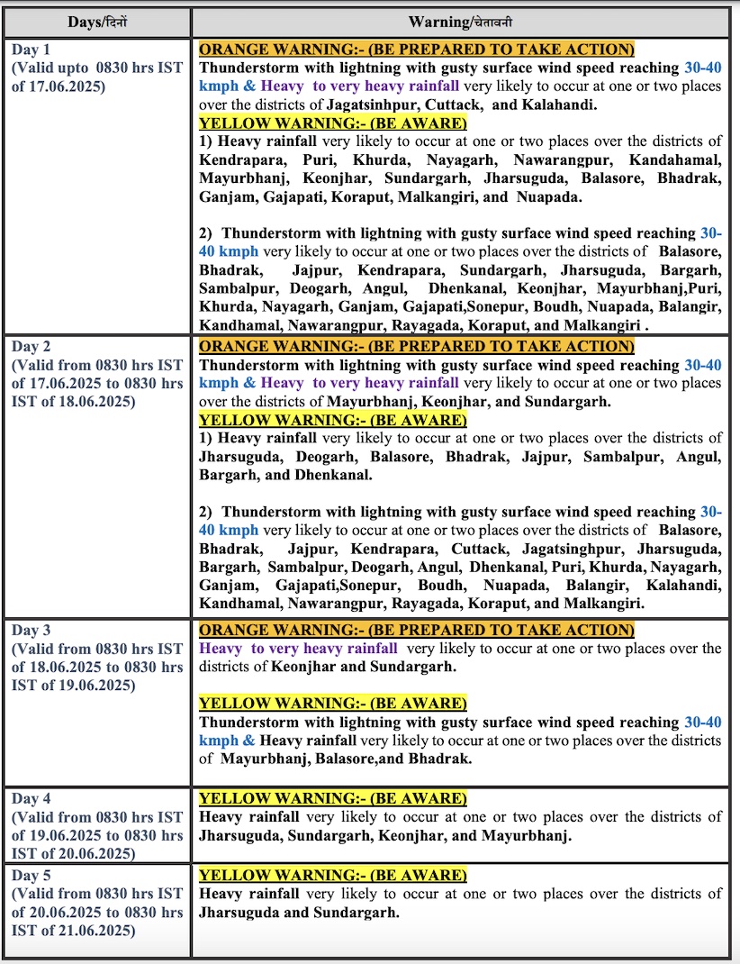
Squally weather with surface wind speed reaching 30-40 kmph gusting to 50 kmph may also prevail over Odisha coast from June 17-18 when sea condition is also likely to be rough. Fishermen have been advised not to venture into the sea along and off Odisha coast during this period.
Meanwhile, southwest monsoon has also further advanced into remaining parts of Odisha.
The weather agency has issued an orange warning for Keonjhar, Sundargarh, Mayurbhanj, Jharsuguda, Sambalpur, Balasore, Bhadrak and Jajpur for three days. While there is a warning for heavy to very heavy rainfall for Keonjhar, Sundargarh, Mayurbhanj and Jharsuguda on June 17, the intensity of rain may increase the following day with extremely heavy downpour in Mayurbhanj. Heavy to very heavy rainfall may also occur at one or two places in Keonjhar, Sundargarh, Sambalpur, Balasore, Bhadrak and Jajpur on June 18. Heavy to very heavy rainfall may continue at one or two places in Sundargarh, Jharsuguda and Sambalpur on June 19. Heavy rainfall may occur at one or two places in Sundargarh on June 20.
Thunderstorm/lightning along with gusty surface wind speed reaching 30-40 kmph is likely only during the next 24 hours.
Check Forecast For Next 4 Days


