Bhubaneswar: Odisha is likely to experience heavy to very heavy rainfall on Thursday under the influence of a low-pressure area over westcentral & adjoining northwest Bay of Bengal off North Andhra Pradesh and South Odisha coasts.
According to the India Meteorological Department (IMD), the system is likely to move west-northwestwards across south Odisha-North Coastal Andhra Pradesh during the next 24 hours.
The weather agency has issued an orange warning of heavy to very heavy rain accompanied by thunderstorm/lightning and gusty surface wind speed reaching 30-40 kmph for one or two places in Rayagada and Gajapati districts. Heavy rain along with thunderstorm/lightning and gusty surface wind speed reaching 30-40 kmph may also occur at one or two places in Koraput, Malkangiri, Ganjam, Nayagarh, Kalahandi, Nabarangpur, Mayurbhanj, Keonjhar, Dhenkanal, Sundargarh, Cuttack and Jajpur. There is also a warning of thunderstorm/lightning and gusty surface wind speed reaching 30-40 kmph for one or two places in Balasore, Bhadrak, Kendrapada, Jagatsinghpur, Puri, Khurda, Angul, Boudh and Kandhamal.
While the intensity of downpour may decrease thereafter, heavy rain may continue in the state till August 18.
Squally weather with wind speed 40-50 kmph gusting to 60 kmph may also prevail along and off Odisha coast, west central and Northwest Bay of Bengal on August 14-15 when sea conditions are likely to be rough to very rough. Fishermen have been advised not to venture into the deep sea along and off Odisha coast, west central and Northwest Bay of Bengal during this period.
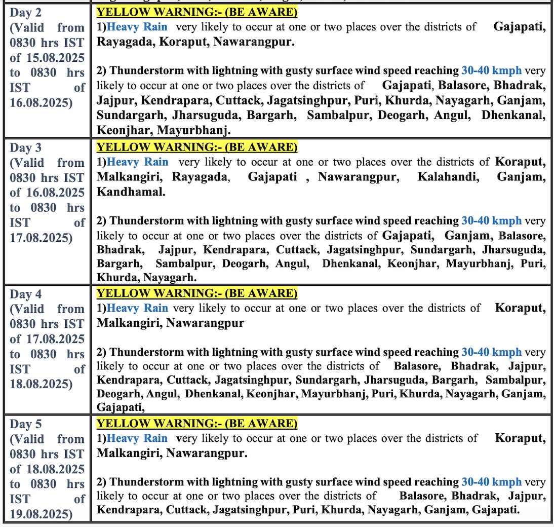
Forecast for next 4 days


